Exclusive: More than 1 million acres of U.S. cropland ravaged by floods

Justin Mensik, corn and soybean farmer, attends to his cattle at his farm in Morse Bluff, Nebraska, U.S. March 22, 2019. REUTERS/Humeyra Pamuk

By P.J. Huffstutter and Humeyra Pamuk

CHICAGO/COLUMBUS, Neb. (Reuters) – At least 1 million acres (405,000 hectares) of U.S. farmland were flooded after the “bomb cyclone” storm left wide swaths of nine major grain producing states under water this month, satellite data analyzed by Gro Intelligence for Reuters showed.

Farms from the Dakotas to Missouri and beyond have been under water for a week or more, possibly impeding planting and damaging soil. The floods, which came just weeks before planting season starts in the Midwest, will likely reduce corn, wheat and soy production this year.

“There’s thousands of acres that won’t be able to be planted,” Ryan Sonderup, 36, of Fullerton, Nebraska, who has been farming for 18 years, said in a recent interview.

“If we had straight sunshine now until May and June, maybe it can be done, but I don’t see how that soil gets back with expected rainfall.”

FILE PHOTO: Paddocks at Washington County Fairgrounds are shown underwater due to flooding in Arlington, Nebraska, U.S., March 21, 2019. REUTERS/Humeyra Pamuk -File Photo

FILE PHOTO: Paddocks at Washington County Fairgrounds are shown underwater due to flooding in Arlington, Nebraska, U.S., March 21, 2019. REUTERS/Humeyra Pamuk -File Photo

Spring floods could yet impact an even bigger area of cropland. The U.S. government’s National Oceanic and Atmospheric Administration has warned of what could be an “unprecedented flood season” as it forecasts heavy spring rains. Rivers may swell further as a deep snowpack in northern growing areas melts.

The bomb cyclone of mid-March was the latest blow to farmers suffering from years of falling income and lower exports because of the U.S.-China trade war.

Fields are strewn with everything from silt and sand to tires and some may not even be farmed this year. The water has also destroyed billions of dollars of old crops that were in storage, as well as damaging roads and railways.

Justin Mensik, a fifth-generation farmer of corn and soybeans in Morse Bluff, Nebraska, said rebuilding roads was the first priority. Then farmers would need to bring in fertilizer trucks and then test soil before seeding, Mensik said.

The flood “left a lot of silt and sand and mud in our fields, now we’re not too sure if we’re going to be able to get a good crop this year with all the new mud and junk that’s just laying here,” Mensik told Reuters.

CORN CONCERN

For farmers, “the biggest concern right now is corn planting,” said Aaron Saeugling, an agriculture expert at Iowa State University who does outreach with farmers. “There is just not going to be enough time to move a lot of that debris.”

To be fully covered by crop insurance, Iowa farmers must plant corn by May 31 and soybeans by June 15, as yields decline dramatically when planted any later. Deadlines vary state by state. The insurance helps ensure a minimum price farmers will receive when they book sales for their crops.

The U.S. Department of Agriculture (USDA) forecast on Friday farmers would increase corn plantings by 4.1 percent from last year, but the estimate did not account for the flooding.

Nearly 1.1 million acres of cropland and more than 84,000 acres of pastureland in the U.S. Midwest had flood water on it for at least seven days between March 8 and March 21, according to a preliminary analysis of government and satellite data by New-York based Gro Intelligence at the request of Reuters. The extent of the flooding had previously not been made public.

The flooded acreage represents less than 1 percent of U.S. land used to grow corn, soybeans, wheat, rice, cotton, sorghum and barley. In 2018, some 240 million total acres of these crops were planted in the United States, USDA data shows.

Iowa, the top U.S. corn and No. 2 soy producing state, had the most water, covering 474,271 acres, followed by Missouri with 203,188 acres, according to Gro Intelligence. That was in line with estimates given to Reuters this week by government officials in Iowa and Missouri.

Gro Intelligence used satellite data from the National Aeronautics and Space Administration’s (NASA) Near Real-Time Global Flood Mapping product, to calculate the approximate extent and intensity of flooding.

Gro Intelligence then identified how much of this area was either cropland or pastureland, according to data from the USDA’s National Agricultural Statistics Service (NASS).

Gro Intelligence analysts cautioned the satellite imagery did not show the full extent of flooding in Nebraska, where officials declined to provide acreage estimates to Reuters, or in North Dakota. Nebraska’s governor has said the floods caused agricultural damage of $1 billion in his state.

Cloud cover or snow on the ground makes it difficult to identify the flood waters in NASA satellite data, said Sara Menker, chief executive of the agricultural artificial intelligence company.

LOST CATTLE

In Missouri, floodwaters covered roughly 200,000 acres in five northwest counties adjoining the Missouri River as of Wednesday morning, said Charlie Rahm, spokesman for USDA’s Natural Resources Conservation Service in Columbia.

In Wisconsin more than 1,000 dairy and beef animals were lost during winter storms and 480 agricultural structures collapsed or damaged, according to an email from Sandy Chalmers, executive director of the Wisconsin state office of the USDA’s Farm Service Agency.

In the Dakotas and Minnesota, melting snows in coming months will put spring wheat planting at risk. Gro Intelligence found nearly 160,000 acres have already been flooded in Minnesota.

“That’s yet to come and we will deal with that at least until the middle of April,” said Dave Nicolai, an agriculture expert at the University of Minnesota.

(Reporting by P.J. Huffstutter in Chicago and Humeyra Pamuk in Nebraska; Additional reporting by Tom Polansek and Karl Plume in Chicago; Writing by Caroline Stauffer; Editing by Simon Webb, Matthew Lewis and James Dalgleish)

Flooding woes add to trade war stress in ‘Trump country’ farm belt

A farm which was damaged by heavy flooding is pictured outside Winslow, Nebraska, U.S., March 20, 2019. Picture taken on March 20, 2019. REUTERS/Humeyra Pamuk

By Humeyra Pamuk and P.J. Huffstutter

COLUMBUS, Neb./CHICAGO (Reuters) – Nebraska grain farmer Ryan Ueberrhein was barely breaking even after the U.S.-China trade war pushed prices for his soybean crop to a decade low. Then the nearby Elkhorn River burst its banks as flooding swept across the U.S. farm belt.

Uberrhein’s farm was left covered in debris after the roiling water receded. He has mounting debts. And he is worried that President Donald Trump may not be able to strike a trade deal with China that would end tariffs on U.S. soybean exports – and allow him to sell whatever grain is left intact at a better price.

Frustration is building across farm country at what feels like a never-ending season of bad news.

The trade war “keeps damaging us,” said Ueberrhein, 34, of Valley, Nebraska, who voted for Trump. “What the president is doing, we stand by him, but … we can’t keep getting hit just because a deal can’t be made quickly.”

U.S. Trade Representative Robert Lighthizer and Treasury Secretary Steven Mnuchin are set to arrive in China this week for another round of trade talks with their Chinese counterparts. The two sides have yet to agree on many core issues.

Farmers who spoke to Reuters remained supportive of Trump.

Soybean exports to China hit a four-year low in February because of the trade war. China is the biggest buyer of U.S. soybeans, which are the largest single U.S. agricultural export. A near halt in exports has hit a rural economy already struggling after years of oversupply cut farm incomes by 50 percent in the past five years.

Debt in the agrarian economy has hit levels last seen during the U.S. farm collapse of the 1980s. (Graphic: https://tmsnrt.rs/2TkUDjk)

The Nebraska Rural Response Hotline, which provides support to farmers and ranchers, has received a record number of calls about financial distress, said John Hansen, president of the Nebraska Farmers Union. Calls about suicide and depression were up, too, he said.

The latest piece of bad news came on March 11, when the Trump administration released its 2020 budget and proposed a 15 percent cut for the U.S. Department of Agriculture, calling its subsidies to farmers “overly generous.”

It did not matter to farmers, who helped vote Trump into office, that the budget will not pass muster with Democrats who control the House of Representatives, Hansen said. Some farmers took the proposed cut to subsidies for crop insurance as an insult.

“How many times do you have to kick us when we’re down?” he said.

That insurance is crucial to Richard Oswald, who farms near Phelps City, Missouri. The flood has already swallowed his childhood home, many of his fields and more than 20,000 bushels of corn. His four grain bins have burst after water-logged corn expanded and split open.

“If our government and leaders can’t step up and start to lead, we’re done for,” he said.

For years, Oswald paid extra for flood insurance. He hoped that government talk of investing in improving U.S. infrastructure would come through – and bolster the levees and dams throughout the Midwest.

But this year, as the trade war dragged on, he dropped the policy to reduce expenses. So he will get no insurance money for the lost corn, Oswald said.

A few days ago, one of his lenders called. Oswald didn’t have to pay the loan right away, the lender said, but he would have to repay it sooner or later.

“Help needs to come from Congress, but Congress is so divided, I don’t know what’s going to happen,” Oswald said.

DISASTER DECLARATION

Trump approved a disaster declaration for Nebraska on Thursday, making federal funding available in nine counties that bore the brunt of the recent floods. On Saturday, he approved one for flood-affected counties in Iowa.

Greg Ibach, a USDA undersecretary, is touring the damage in Nebraska, and Bill Northey, another undersecretary, will head to Iowa, agency officials told Reuters.

U.S. Senator Chuck Grassley of Iowa said the farm belt states would need more aid, suggesting a separate relief bill to offer compensation to farmers for livestock killed in the floods and grains in storage that will have to be destroyed.

“The United States government has always been the insurance of last resort,” Grassley said in a phone interview on Friday.

Nebraska Governor Pete Ricketts put agricultural flood damage for the state at nearly $1 billion. Iowa officials are projecting losses of at least $1.6 billion, with at least $214 million in damage to the agriculture sector. Iowa Governor Kim Reynolds said her state would need assistance beyond what is granted through disaster declarations.

Farmers, meanwhile, are staring at waterlogged fields and expecting more floods. The U.S. National Oceanic and Atmospheric Administration said last week that the flooding would worsen in coming weeks as snow on the ground melts and water flows downstream.

Iowa farmer Dave Newby said the standing water in his fields was already threatening his planned start to corn in mid-to-late April. Newby, like many farmers, had been looking to boost his corn plantings this year because such a large volume of soybeans had been left unsold because of the trade war.

The same was the case in nearby Nebraska. Parts of flooded farmland remained under water and farmers had yet to assess the damage the piled-up sand, silt and debris caused to the soil. Almost all said planting will likely be delayed, which could lead to lower yields.

“Normal planting would take place around May 1, but I doubt we will make it,” said Kendal Sock, a cattle and corn farmer in Genoa. “I wish they’d get this trade deal done, like now.”

(Reporting by Humeyra Pamuk and P.J. Huffstutter; Additional reporting by Mark Weinraub and Tom Polansek in Chicago and Jarrett Renshaw in New York; Editing by Caroline Stauffer, David Gaffen, Simon Webb and Leslie Adler)

Missouri River towns face deluge as floods move downstream

A flooded parcel of land along the Platte River is pictured in this aerial photograph at La Platte, south of Omaha, Nebraska, U.S. March 19, 2019. REUTERS/Drone Base

By Humeyra Pamuk

VALLEY, Neb. (Reuters) – A string of small Missouri towns prepared for the next deluge along the raging Missouri River on Wednesday after flooding wreaked nearly $1.5 billion in damage in Nebraska, killing at least four people and leaving another man missing.

High water unleashed by last week’s late-winter storm and melting snow has already inundated a large swath of Missouri, Nebraska and Iowa along the Missouri River, North America’s longest river. States of emergency have been declared in all or parts of the three Midwestern farm states.

The Missouri River’s next major flood crest was forecast to hit St. Joseph, Missouri, at 6 a.m. on Friday and Kansas City, Missouri, 55 miles (88 km) to the south, about 24 hours later, said Mike Glasch of the Omaha District of the U.S. Army Corps of Engineers.

Homeowners and businesses across Leavenworth County, Missouri, where 81,000 people were under a flood warning on Wednesday, were placing sandbags around property as they have watched the river rise over the last few days, Kim Buchanan, the county’s deputy director of emergency management, told Reuters.

“We have moderate flooding at this time,” she said, noting that the forecast shows the river cresting seven feet above flood stage on Thursday or Friday. “Anybody with river interest has already instigated their flood plans and have taken their defensive actions.”

FOUR DEAD

The floods killed four people in Nebraska and Iowa since last week, and officials warned the damage toll would rise as receding waters revealed more devastated roadways, bridges and homes.

A fifth man has been missing since the collapse of the Spencer Dam along the Niobrara River last. He was identified by the Omaha World-Herald newspaper as Kenny Angel.

Authorities said they had rescued nearly 300 people in Nebraska alone.

FILE PHOTO: Homes sit in flood waters after leaving casualities and causing hundreds of millions of dollars in damages, with waters yet to crest in parts of the U.S. midwest, in Peru, Nebraska, U.S., March 19, 2019. REUTERS/Karen Dillon

FILE PHOTO: Homes sit in flood waters after leaving casualities and causing hundreds of millions of dollars in damages, with waters yet to crest in parts of the U.S. midwest, in Peru, Nebraska, U.S., March 19, 2019. REUTERS/Karen Dillon

A levee break prompted the evacuation of the small community of Craig, Missouri. Real estate agent Jamie Barnes said everyone in town had time to get out before it was flooded, and water was now flowing south through farmland toward communities such as Forest City, Forbes and St Joseph.

“There’s just water as far as the eye can see, from bluff to bluff. In some places its five miles, in some 15,” Barnes said by phone.

Several other communities in that area of northwest Missouri have also been evacuated, the Army Corps of Engineers said at a briefing.

“Much of the levee system remains compromised, and as of noon Wednesday there are more than 30 total breaches across the system,” in the three states experiencing flooding, Lieutenant Colonel James Startzell, deputy commander of the U.S. Army Corps of Engineers Omaha District told the briefing.

AIR FORCE BASE FLOODED

“I was driving out to get one more load of corn from the bins when the levee broke, and there was a wall of water coming at me,” said Howard Geib, 54, whose farm is near Craig. “I was on the phone with my son-in-law, who was driving out to help, telling him, ‘Stop! Stop! Turn around!'”

The flooding killed livestock, destroyed grains in storage and cut off access to farms because of road and rail damage.

Across the Missouri from Craig, the village of Rulo, Nebraska, drew a small crowd of onlookers to see the deluge, said Kelly Klepper, owner of Wild Bill’s Bar & Grill.

“We’re kind of a tourist attraction right now,” Klepper said by phone.

Missouri emergency managers said they may be spared the worst of the flooding because of breaches further north.

“It’s really sad that we had a couple levies fail upstream, but that’s helped everyone downstream,” said Steven Bean of Kansas City’s emergency management agency.

But Bean said the kind of flooding hitting the Midwest is typically seen in June and July, after the final snow-melt and the spring rains.

“This is March, and we haven’t had the final snowmelt,” he said. “We haven’t had the spring rains. The reservoir is full. They have got to get it empty.”

More than 2,400 Nebraska homes and businesses were destroyed or damaged, with 200 miles (322 km) of roads unusable and 11 bridges wiped out, Governor Pete Ricketts said on Wednesday.

Ricketts estimated the floods caused at least $439 million in damage to public infrastructure and other assets and $85 million to privately owned assets. He put flood damage for the state’s agricultural sector at nearly $1 billion.

Offutt Air Force Base near Omaha, which houses the U.S. Strategic Command, remained heavily flooded, though base officials said on Twitter the facility was still “mission-capable.”

In Valley, Nebraska, outside Omaha, Pete Smock, 42, worked to clear deep mud surrounding his home and construction business.

“Devastation is everywhere. I haven’t seen anything like this in my lifetime,” Smock said. He had rented heavy equipment to fill deep holes cut by the floods with gravel and repair driveways leading to his office and garage.

(Reporting by Humeyra Pamuk; Additional reporting by Gina Cherelus in New York, Rich McKay in Atlanta, Jarrett Renshaw in Philadelphia, P.J. Huffstutter and Mark Weinraub in Chicago, Brendan O’Brien in Milwaukee, Andrew Hay in Taos, N.M. and Steve Gorman and Dan Whitcomb in Los Angeles; Writing by Dan Whitcomb; Editing by Bill Tarrant and Alistair Bell)

Death toll in Mozambique cyclone, floods could surpass 1,000: president

Flooding caused by Cyclone Idai is seen in Chipinge, Zimbabwe, March 16, 2019 in this still image taken from social media video obtained March 17, 2019. Tony Saywood via REUTERS

MAPUTO/HARARE (Reuters) – The number of people killed in a powerful storm and preceding floods in Mozambique could exceed 1,000, the president said on Monday, putting the potential death toll greatly more than current figures.

Only 84 deaths have been confirmed so far in Mozambique as a result of Cyclone Idai, which has also left a trail of death and destruction across Zimbabwe and Malawi, with vast areas of land flooded, roads destroyed and communication wiped out.

Speaking on Radio Mocambique, President Filipe Nyusi said he had flown over the affected region, where two rivers had overflowed. Villages had disappeared, he said, and bodies were floating in the water.

“Everything indicates that we can register more than one thousand deaths,” he said.

The cyclone has also killed 89 people in Zimbabwe, an official said on Monday, while the death toll in Malawi from heavy rains and flooding stood at 56 as of last week. No new numbers had been released following the cyclone’s arrival in the country.

Caroline Haga, a senior International Federation of the Red Cross official who is in Beira, said the situation could be far worse in the surrounding areas, which remained completely cut off by road and where houses were not as sturdy.

Nyusi flew over areas that were otherwise accessible, and some of which had been hit by flooding before Cyclone Idai.

RESCUE EFFORT

In Beira, Mozambique’s fourth-largest city and home to 500,000 people, a large dam had burst, further complicating rescue efforts.

Large swathes of land were completely submerged, and in some streets people waded through knee-high water around piles of mangled metal and other debris.

In the early hours of Monday morning, rescuers launched dinghies onto chest-high waters, navigating through reeds and trees – where some people perched on branches to escape the water – to rescue those trapped by the flooding.

Meanwhile, rescuers were struggling to reach people in Zimbabwe’s Chimanimani district, cut off from the rest of the country by torrential rains and winds of up to 170 km per hour that swept away roads, homes and bridges and knocked out power and communication lines.

Zimbabwean information ministry official Nick Mangwana told Reuters the number of confirmed deaths throughout the country was now 89. The body count is expected to rise.

Many people had been sleeping in the mountains since Friday, after their homes were flattened by rock falls and mudslides or washed away by torrential rains.

The Harare government has declared a state of disaster in areas affected by the storm. Zimbabwe, a country of 15 million people, was already suffering a severe drought that has wilted crops.

SOUTHEASTERN AFRICA GATEWAY

Beira, which sits at the mouth of the Pungwe River, is also home to Mozambique’s second-largest port, serving as gateway for imports to landlocked countries in southeast Africa.

The director of a company that jointly manages the port, Cornelder, based in the Netherlands, said the port had been closed since last Wednesday but would hopefully resume operations on Tuesday.

Two cranes would be working and the company had two large generators and enough fuel for now, though damage to access routes and roads further inland was more likely to cause a problem, said the director, who asked not to be named.

The fuel pipeline running from Beira to Zimbabwe was believed to be intact, the person said, though communication was still very patchy and therefore the situation at the port remained uncertain.

In February 2000, Cyclone Eline hit Mozambique when it was already devastated by its worst floods in three decades. It killed 350 people and made 650,000 homeless across southern Africa, also hitting Zimbabwe.

(Reporting by MacDonald Dzirutwe in Zimbabwe and Manuel Mucari in Mozambique; Additional reporting by Emma Rumney in Johannesburg; Editing by Angus MacSwan)

Spring weather to bring more floods to waterlogged U.S. Plains states

Highway 281 is seen damaged after a storm triggered historic flooding, in Niobrara, Nebraska, U.S. March 16, 2019. Office of Governor Pete Ricketts/Handout via REUTERS

(Reuters) – The U.S. Central Plains states could face more flooding this week as rising temperatures accelerate snow melt across the region, weather forecasters said Monday.

Floods in the aftermath of a late-winter storm that dumped snow and rain on the nation’s midsection last week have already killed two people and destroyed homes and businesses.

“The good news is that apart from some very light rain tonight, this will be generally a dry week across the region,” said Bob Oravec, a meteorologist with the National Weather Service’s (NWS) Weather Prediction Center.

“But we’re in a warming trend. Slightly above average springtime temperatures means more water from snowmelt is going into already flooded river basins,” Oravec said.

Temperatures across the hardest-hit areas of Nebraska and Iowa will be reach highs in the low 50 degrees Fahrenheit through midweek and into the 60s by Friday, he said.

Water levels are expected to rise through the week, according to the NWS, prompting evacuations in communities along the Missouri River on the Nebraska and Iowa border, as well as the Elkhorn and Platte rivers in Nebraska.

Flooding is not expected to abate until at least midweek in the Plains and Midwest region, the NWS reported.

“The big ones (rivers) are at record stages right now,” Marc Chenard of the NWS said Sunday. “There have been some levy breaks so there are towns that are flooded.”

Nebraska Governor Pete Ricketts, who declared a statewide emergency last week, wrote on Twitter that he witnessed “unbelievable devastation” when he visited several flooded communities on Saturday.

“Getting an update from local officials and public safety personnel in Missouri Valley today. Rain and melting snow have caused severe flooding all across Iowa,” Iowa Governor Kim Reynolds said on Sunday on Twitter.

Reynolds also issued an emergency proclamation at the outset of the flooding.

The weather was blamed for two deaths, including one person who died at home after failing to evacuate, and a man swept away while trying to tow a trapped car with his tractor.

Some small towns and communities have been cut off by floods while others have seen fresh drinking water become scarce.

Meteorologists have referred to the storm, which blew from the Western Rockies to the Central Plains last week, as a “bomb cyclone” — a winter hurricane that forms when the barometric pressure drops 24 millibars in 24 hours.

“That system brought 1 to 3 inches of rainfall but, on top of that, there was already a deep snowpack over much of the area. So a combination of the rain and snow melt had a large volume of water going pretty quickly into the rivers,” Chenard said.

(Reporting by Rich McKay in Atlanta, Barbara Goldberg in New York and Dan Whitcomb in Los Angeles; Editing by Catherine Evans)

Death toll in floods in Indonesia’s Papua rises to nearly 80

Cars are submerged in mud following a flash flood in Sentani, Papua, Indonesia, March 17, 2019 in this photo taken by Antara Foto. Antara Foto/Gusti Tanati/ via REUTERS

JAKARTA (Reuters) – Authorities in Indonesia raised the death toll from floods and landslides in the easternmost province of Papua to nearly 80 on Monday as President Joko Widodo called for the urgent evacuation of victims from devastated communities.

The deadly floods and landslide struck at the weekend after torrential rain fell across the Cyclops mountain range, much of which has been stripped of tree cover by villagers chopping fire wood and farmers cultivating plantations.

The death toll shot up to nearly 80 from 58 on Sunday as rescuers found more victims as they struggled to clear mud, rocks and shattered trees from the area near the provincial capital of Jayapura, including a 70 km stretch of road.

With 43 people missing, Widodo urged rescuers to step up their efforts.

“What is most important is handling the evacuation,” he said in a statement posted on Instagram.

More than 4,000 people have been displaced and are sheltering in tents, schools, and public buildings.

Disaster authorities have warned provincial officials of the danger of flash floods due to deforestation, said Sutopo Purwo Nugroho, spokesman of the national disaster mitigation agency.

The central government sent supplies of seedlings last year, hoping to help restore some forest cover, he said.

(Reporting by Jessica Damiana; Writing by Kanupriya Kapoor)

Nebraska preps nuclear plant for possible flooding, no public danger

Corp of Engineers photo of the nuclear power plant during the 2011 Missouri River flooding

(Reuters) – Nebraska Public Power District (NPPD) on Friday declared an “unusual event” at its Cooper nuclear power station in Nebraska due to the possibility of flooding along the Missouri River following a powerful winter storm this week.

The plant continues to operate safely and “there is no threat to plant employees or to the public,” the utility said in a release.

The late winter storm, dubbed a “bomb cyclone” by meteorologists, left blizzards, floods and tornados in its wake after hitting the U.S. Mountain and Plains states this week, before pushing east into the Midwest and the Great Lakes Region early Friday.

NPPD said its workers have filled sandbags along the river levee and procured other materials and supplies for flood protection.

The biggest danger to a nuclear plant from flooding is the loss of power, which can make it difficult to cool the uranium fuel in the reactor core and the fuel stored in the spent fuel pool.

That is what caused the fuel in some reactor cores at the Fukushima Daiichi plant in Japan to partially melt down in 2011 after a giant earthquake and tsunami cut power to the plant.

Since Fukushima, all U.S. reactors have been upgraded with additional safety equipment, including portable pumps and generators to keep cooling water circulating through the reactor in case the plant loses offsite power.

NPPD said its procedures require it to declare an unusual event to the U.S. Nuclear Regulatory Commission when the Missouri River tops 899 feet above sea level. It reached 899.05 feet Friday morning, the company said.

Should the river rise to 900 feet above sea level, NPPD said plant workers will “barricade internal doorways as another layer of protection for facility equipment.”

If the river reaches 901.5 feet above sea level, NPPD said it would take the station offline as a protective measure.

The plant was built at 903 feet above sea level, which is 13 feet above natural grade, NPPD said.

The Cooper station is three miles (4.8 km) southeast of Brownville, Nebraska, near the Missouri River.

(Reporting by Scott DiSavino; Editing by David Gregorio and Richard Chang)

Blizzard threatens U.S. central plains with two feet of snow

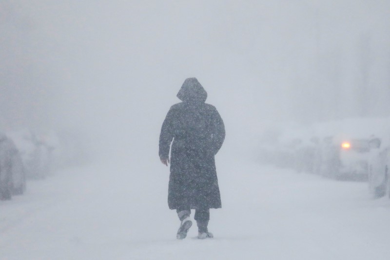
A woman walks down the street during a blizzard in Long Beach, New York, U.S. January 4, 2018.

By Peter Szekely

(Reuters) – A late-winter storm this week could dump up to two feet (60 cm) of snow in the U.S. central Plains states, potentially snarling travel and bringing flooding to the Upper Midwest, U.S. forecasters said on Tuesday.

The storm, now brewing as low-pressure center in the southwest, will quickly move into the Rocky Mountains and deliver one to two feet of snow with blizzard conditions in much of Colorado and parts of Wyoming, Nebraska and South Dakota, the National Weather Service predicted.

The biggest air travel hub likely to be affected by the snow is Denver International Airport, but cross-continental air travel lanes could be disrupted as well as the system brings a line of rain squalls eastward, forecasters said.

“The snow will really start picking up by later tonight into the day on Wednesday,” meteorologist Mark Chenard said in a Tuesday phone interview from the NWS Weather Prediction Center in College Park, Maryland.

The storm will also bring heavy rain to areas of eastern Nebraska, Iowa, Wisconsin and Minnesota that already have a good deal of snow on the ground, the NWS said.

“We could have the potential for major river flooding, given the rain and the snow melt,” Chenard said.

An earlier round of heavy, wet snow caused several roofs to collapse in the Upper Midwest last weekend, including those of a church and a hotel.

By Thursday, the storm system will weaken as it moves over the Tennessee River Valley, bringing mostly rain from Michigan southward to the Gulf Coast and some remaining snow only in the far northern parts of the country, he added.


(Reporting by Peter Szekely in New York; Editing by Scott Malone and Steve Orlofsky)

‘Pineapple Express’ storm douses California with rain, snow

Snow capped mountains are seen behind the downtown Los Angeles skyline, California, U.S., February 12, 2019. REUTERS/Lucy Nicholson

By Andrew Hay

(Reuters) – A Pacific storm system known as the “Pineapple Express” threatened to dump up to 8 inches of rain and 8 feet of snow on areas of California, raising risks of flooding and mudslides, meteorologists said on Wednesday.

“The (Pineapple) Express is no joke,” said Bob Oravec, meteorologist with the National Weather Service’s Weather Prediction Center in College Park, Maryland of the strongest weather system of the season.

The weather system, also known as an atmospheric river, gets its name from the flow of moisture that periodically heads east from waters adjacent to the Hawaiian Islands to soak the U.S. West Coast. It blanketed parts of Hawaii with snow over the weekend and is expected to drench California.

The San Francisco Bay area could be hit by flash flooding and falling trees as saturated ground gets up to 8 inches more rain and strong winds blow in, the weather service said.

“We’re talking 3 to 5 inches of rain in San Francisco and coastal areas in just the next 24 hours, and more on into Friday,” Oravec said.

To the northeast in the Sierra Nevada Mountains, passes could see between 80 and 100 inches (approximately 7 to 8 feet) of snow through Friday.

Valley areas face flood watches over fears the relatively warm Pineapple Express system could initially drench areas as high as Lake Tahoe with rain, melting snow and swelling rivers.

WILDFIRE BURN AREAS

The Central and Southern California coast can expect flash flooding and possible mudslides near recent wildfire burn areas, the NWS reported.

Oravec said that the problem is not just the amount of rain, but the fact that it will hit in a short amount of time.

“It’s going to be heavy and fast,” he said. “Debris flows and mudslides are a risk in any area scorched by the wildfires. There’s little to no vegetation to slow that water down.”

Up to 2 inches of rain was expected in the Los Angeles area between Tuesday evening and Thursday morning, the weather service said.

A string of winter storms has swelled snowpack in California to above-average levels, delighting farmers in need of water and skiers in search of powder.

(Reporting by Andrew Hay, additional reporting by Rich McKay, editing by Louise Heavens)

Death toll from Philippine landslides, floods climbs to 85

Rescue workers carry a body bag containing remains of victims following a landslide at Cisolok district in Sukabumi, West Java province, Indonesia, January 1, 2019 in this photo taken by Antara Foto. Picture taken January 1, 2019. Antara Foto/Nurul Ramadhan/ via REUTERS

MANILA (Reuters) – The death toll from landslides and devastating floods in the central Philippines triggered by a tropical depression climbed to 85, officials said on Wednesday, and 20 people were missing as rescuers slowly reached cut-off communities.

The casualties, including young children, were mostly killed when their homes collapsed in landslides after days of heavy rain in several provinces in the central Philippines, said Ricardo Jalad, executive director of the national disaster agency.

“If we don’t recover the missing or we recover them dead, that is 105 deaths, which we hope not,” Jalad said.

A resident carries his livestock following a landslide at Cisolok district in Sukabumi, West Java province, Indonesia, January 1, 2019 in this photo taken by Antara Foto. Picture taken January 1, 2019. Antara Foto/Nurul Ramadhan/ via REUTERS

A resident carries his livestock following a landslide at Cisolok district in Sukabumi, West Java province, Indonesia, January 1, 2019 in this photo taken by Antara Foto. Picture taken January 1, 2019. Antara Foto/Nurul Ramadhan/ via REUTERS

The tropical depression, which weakened into a low pressure system before leaving the Philippines on Sunday, brought heavy rain that triggered landslides and flooding in the Bicol and eastern Visayas regions.

Officials put three provinces under a “state of calamity” to give them access to emergency funds.

Bicol, with a population of 5.8 million, was the hardest hit, with 68 killed in intense rains and landslides. Damage to agriculture in Bicol, which produces rice and corn, was estimated at 342 million pesos ($6.5 million).

Rescuers, including the police and military, used heavy-lifting equipment to clear roads leading to landslide sites and entered flooded communities using rubber boats.

“The sun is already out, with occasional light rains. We hope floods will subside,” Ronna Monzon, a member of the operations personnel at the disaster agency in Bicol, told Reuters.

About 20 tropical cyclones hit the Philippines every year, with destroyed crops and infrastructure taking a toll on human lives and weighing down one of the fastest growing economies in Asia.

(Reporting by Neil Jerome Morales and Karen Lema; Editing by Paul Tait)