Deep freeze keeps grip on eastern United States; four die

Elena Barduniotis from Colorado waits in Times Square ahead of New Year's celebrations in Manhattan.

By Brendan O’Brien

MILWAUKEE (Reuters) – A record-shattering Arctic freeze kept its grip on much of the United States east of the Rocky Mountains on Tuesday but temperatures everywhere except the Northeast were expected to warm within 24 hours.

Many school districts shut their classrooms due to the cold snap, which claimed four lives over the long New Year’s weekend.

The National Weather Service issued wind chill warnings for Tuesday as dangerously low temperatures were due from eastern Montana across the Midwest into the Atlantic coast and the Northeast and down through the deep South.

School districts in Iowa, Massachusetts, Indiana, Ohio and North Carolina canceled or delayed the start of classes as bitterly cold temperatures, 20 degrees to 30 degrees Fahrenheit (11 to 17 degrees Celsius) below normal, were expected across the eastern half of the United States.

“Just the bitter cold which is just too dangerous to put kids out on the street waiting for a bus that may not come,” Herb Levine, superintendent of the Peabody Public Schools, north of Boston, told a local CBS affiliate television station.

The cold was blamed for the deaths of two men in separate incidents in Milwaukee, according to the Milwaukee Journal Sentinel. A homeless man was found dead on a porch in Charleston, West Virginia, while another man was found dead outside a church in Detroit and police said he may have froze to death, local news outlets reported.

Washington Mayor Muriel Bowser urged residents to call the city if they saw people outside.

“We want every resident to have shelter and warmth,” she said in a tweet.

Many places across the United States experienced record low temperatures over the last few days. Omaha, Nebraska, posted a low of minus 20F (minus 29C), breaking a 130-year-old record, and Aberdeen, South Dakota, shattered a record set in 1919 with a temperature of minus 32F (minus 36C).

The cold should ease across most of the country after Tuesday, but the northeastern section of the country will see a repeat of the frigid weather on Thursday or Friday as another arctic blast hits the area.

Private AccuWeather forecaster said the cold snap could combine with a storm brewing off the Bahamas to bring snow and high winds to much of the Eastern Seaboard as it heads north on Wednesday and Thursday.

(Reporting by Brendan O’Brien in Milwaukee; Editing by Raissa Kasolowsky and Jeffrey Benkoe)
Ahead of storm, U.S. planes, trains and trucks diverted, canceled

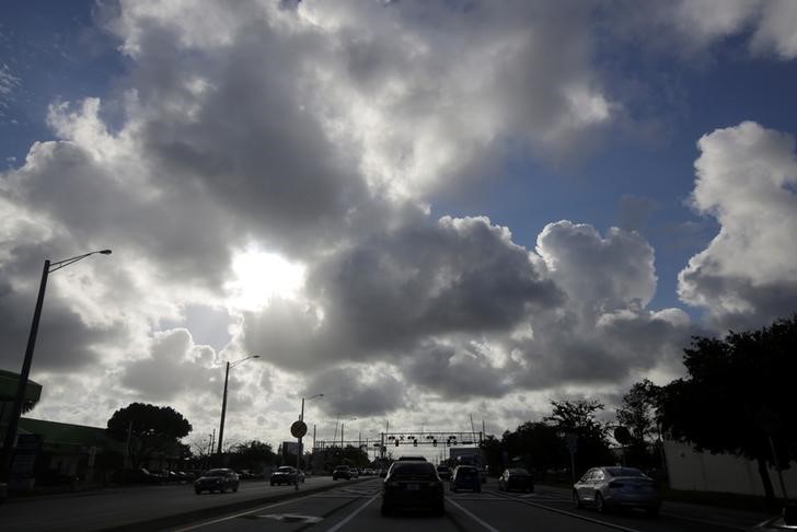
Cars are seen along Deerfield beach near Coral Springs while Hurricane Matthew approaches in Florida

By Nick Carey

CHICAGO (Reuters) – Hundreds of flights have been canceled, Florida airports are being shuttered and train services suspended as Hurricane Matthew heads toward the U.S. southeastern coast, with passengers and goods likely to be stranded or delayed through Saturday.

Atlanta-based Delta Airlines said 130 flights were canceled on Thursday after the airline halted operations at southern Florida airports including Miami. A further 150 will be canceled on Friday as Florida airports further north such as Orlando are affected. Additional cancellations are expected for Georgia and South Carolina on Saturday, the airline said.

A spokeswoman for Chicago-based United Airlines said the company canceled 180 flights from Wednesday through Saturday affecting Miami, Fort Lauderdale, West Palm Beach, Orlando and Jacksonville.

“This is a very fluid situation, so we are ready to change and cancel more flights as needed,” she said.

American Airlines has canceled flights in southern Florida starting Thursday afternoon, which should resume by midday on  Friday. The airline said Orlando flights will cease late on Thursday afternoon, with a reduced service resuming Saturday morning. Jacksonville flights will cease on Friday morning and  reduced service will resume on Saturday.

Southwest Airlines Co said it had canceled 60 flights for Thursday due to the hurricane.

A FedEx spokeswoman said the package delivery company is implementing unspecified contingency plans but warned of potential service delays or disruptions.

“Contingency plans are being implemented to ensure that shipments arrive at their final destinations as quickly as conditions permit,” said Glenn Zaccara, a spokesman for rival United Parcel Service Inc.

Operations on No. 3 U.S. railroad CSX Corp’s main Florida line from Auburndale into Jacksonville would cease late on Thursday afternoon, spokeswoman Melanie Cost said.

Services from Florida into Georgia, South Carolina and North Carolina would be curtailed until after the storm passes, she added.

No. 4 U.S. railroad Norfolk Southern Corp is moving equipment away from Southeast coastal areas and transferring shipments inland to secured rail yards. Traffic en route to affected regions is being held at yards throughout the Norfolk Southern system to alleviate congestion in those areas.

Miami-based trucking and logistics company Ryder System Inc will close its headquarters during the storm, spokesman David Bruce said. But he added that Ryder is “repositioning rental trucks to the affected areas and working to ensure an uninterrupted fuel supply for our customers in the days after the storm passes.”

(Reporting By Nick Carey; Editing by Cynthia Osterman)

Hermine lingers off U.S. East Coast

A woman walks her dog at Rockaway Beach in Queens, New York on Labor Day while high waves reached the shore due to post-tropical cyclone Hermine which tracked off the east coast of the U.S.

Reuters) – Hermine, a storm that raked Florida with hurricane-force winds last week, lingered on Tuesday off the U.S. East Coast where it was expected to produce heavy gusts and rain over the next two days.

Forecasters warned swimmers and boaters to stay out of treacherous waters and rough surf. New York City said all public beaches would be closed through Tuesday because of “life-threatening” rip currents.

At 2 a.m. EDT on Tuesday, Hermine’s center was about 110 miles (175 km) southeast of the eastern tip of Long Island and expected to move northwest at about 9 mph (15 kph).

Hermine was forecast to bring up to 2 inches (5 cm) of rain to Rhode Island and southern Massachusetts through Wednesday, the National Weather Service said.

A tropical storm warning remained in effect from the eastern end of New York’s Long Island and to Martha’s Vineyard and Nantucket Island off Massachusetts.

On Cape Cod and its islands, high surf and wind put a crimp in the Labor Day plans of many people looking to celebrate summer’s end, but some beaches farther south reopened.

Hermine was classified as a Category 1 hurricane when it slammed into Florida’s Gulf Coast on Friday. It became a post-tropical storm by week’s end after its winds dropped below 74 miles per hour (119 kph) and it lost its tropical characteristics.

The storm, which crossed northern Florida and then moved up the Georgia and the Carolina coasts, was packing sustained surface winds of up to 65 mph (100 kph) with higher gusts, the National Weather Service said.

“Just because it’s a post-tropical cyclone doesn’t mean the impact of tropical force winds, winds in general and storm surge go away,” said National Hurricane Center spokesman Dennis Feltgen.

The storm has claimed at least three lives, in Florida and in North and South Carolina. The third reported death was that of a man struck by a car on a South Carolina highway on Friday as he tried to move a fallen tree, a Colleton County fire department spokesman said.

Hermine became the first hurricane to make landfall in Florida in 11 years, packing winds of 80 mph (130 kph), and knocking out power to 300,000 homes and businesses.

(Reporting by Brendan O’Brien in Milwaukee)

Lurking Hermine spares much of U.S. East Coast, could regain hurricane strength

Tropical Storm Hermine is pictured off the coast of the U.S. Mid-Atlantic

By Daniel Trotta and Chris Prentice

NEW YORK (Reuters) – Atlantic storm Hermine, which has killed two people, lurked off the middle of the U.S. East Coast late on Sunday while threatening to regain hurricane strength, after having spared the region the brunt of its wind, rain and tidal surge.

Forecasters warned swimmers and boaters to avoid the risk of deadly surf churned up by the storm and stay out of treacherous waters during the Labor Day holiday weekend, when many Americans celebrate the end of summer.

Hermine was still packing maximum sustained surface winds of nearly 70 mph (113 kph) late on Sunday, and forecasters said it  could intensify slightly to reach hurricane strength again, before it starts to dwindle later on Monday.

But for now, its strongest winds were extending outward by about 230 miles (370 km), failing to reach U.S. shores.

Hermine was forecast to bring up to 2 inches (5 cm) of rain to southern New England on Monday, after having hit land in Florida on Friday, and churning up the southeastern seaboard.

Sandbags and tarps cover the entrance to a subway station near Battery Park as New York City prepares for potential flooding as post-tropical storm Hermine stalls off the east coast of the United States

Sandbags and tarps cover the entrance to a subway station near Battery Park as New York City prepares for potential flooding as post-tropical storm Hermine stalls off the east coast of the United States, September 4, 2016. REUTERS/Mark Kauzlarich

Then it merged with a conventional weather front, to be reclassified on Saturday as a post-tropical cyclone.

But Hermine was not expected to make landfall again, said Robbie Berg, an official of the National Hurricane Center.

A tropical storm warning remained in effect Sunday night from the Delaware and New Jersey shores north to New York’s Long Island and beyond to Martha’s Vineyard and Nantucket Island off Massachusetts, but was canceled for New York City, which Berg said appeared largely out of harm’s way.

Potential storm-surge inundation levels of no more than 1 to 3 feet (30 cm to 1 m) were expected in coastal areas.

As the threat to New Jersey waned, Governor Chris Christie ordered Island Beach State Park reopened for Monday, while warning that lingering rip currents and rough surf might still make the ocean unsafe for swimmers.

At 11 p.m. EDT on Sunday, Hermine’s center was about 325 miles (523 km) southeast of Long Island, the eastern tip of New York, the hurricane center said.

It was expected to “meander slowly” off the mid-Atlantic region, moving north-northeast at only 3 mph (5 kph) and stay at least 300 miles (480 km) from shore before beginning to weaken by Monday night, the agency said.

WANING STORM THREAT BEYOND COAST

The storm claimed at least two lives, in Florida and North Carolina, but the widespread power outages and flooding that battered Florida, Georgia and the Carolinas had yet to materialize farther north, where alarming news reports scared many tourists away from the beach on Sunday.

Those who stayed awoke to sunshine, but stronger-than-usual winds and choppy seas.

“It was a little overhyped by the media,” said Andrew Thulin, assistant general manager of Daddy O Hotel Restaurant in the New Jersey township of Long Beach.

“It killed the weekend for everybody down here.”

Officials mindful of the 2012 devastation of Superstorm Sandy took every precaution. Elsewhere in the state coastal roads were reported flooded, and beaches engulfed by the sea.

Hermine became the first hurricane to make landfall in Florida in 11 years, packing winds of 80 mph (129 kph), and knocking out power to 300,000 homes and businesses. Downgraded to a tropical storm within hours, it still packed a wallop.

(Additional reporting by Steve Gorman from Los Angeles and Chris Michaud from New York)