Power Outage across southeast

Luke 21:7 & 11 “Teacher,” they asked, “when will all this happen? What sign will show us that these things are about to take place?”  11 “There will be great earthquakes, and there will be famines and epidemics in many lands, and there will be terrifying things (that which strikes terror), and great miraculous signs in the heavens.”

Important Takeaways:

  • Winter Storm Knocks Out Power Across Southeast
  • More than 250,000 customers in Virginia were without electricity, with an additional 176,000 outages in North Carolina and more than 100,000 in Georgia, according to PowerOutage.us
  • Ahead of the storm, Mayor Muriel Bowser of Washington declared a snow emergency in the District of Columbia
  • Larry Hogan of Maryland mobilized state resources, and Gov. Philip D. Murphy of New Jersey declared a state of emergency for five counties, warning residents to stay off the roads.
  • In Delaware, state government offices were closed
  • Parts of Delaware, Maryland and New Jersey could see up to a foot of snow on Monday, with wind gusts as high as 40 miles per hour

Read the original article by clicking here.

Wind, flooded roads herald approach of Hurricane Florence in North Carolina

The Union Point Park Complex is seen flooded as the Hurricane Florence comes ashore in New Bern, North Carolina, U.S., September 13, 2018. REUTERS/Eduardo Munoz

By Ernest Scheyder and Anna Mehler Paperny

WILMINGTON/WASHINGTON, N.C. (Reuters) – The outer reaches of Hurricane Florence began lashing coastal North Carolina with heavy winds and flooded roads on Thursday ahead of an expected landfall that will bring walls of water and lingering downpours.

The center of Florence is expected to hit North Carolina’s southern coast Friday, then drift southwest before moving inland on Saturday, enough time to drop as much as 40 inches (1 meter) of rain in places, according to the National Hurricane Center.

Pararescue personnel from the Alaska Air National Guard's 212th Rescue Squadron, 176th Wing, and California ANG's 131st Rescue Squadron, 129th Rescue Wing, settle into a C-17 Globemaster III aircraft in preparation for offering support to Hurricane Florence relief operations, at Moffett Federal Airfield, California, in this September 12, 2018 handout photo. Staff Sgt. Balinda O'Neal Dresel/U.S. Army National Guard/Handout via REUTERS

Pararescue personnel from the Alaska Air National Guard’s 212th Rescue Squadron, 176th Wing, and California ANG’s 131st Rescue Squadron, 129th Rescue Wing, settle into a C-17 Globemaster III aircraft in preparation for offering support to Hurricane Florence relief operations, at Moffett Federal Airfield, California, in this September 12, 2018 handout photo. Staff Sgt. Balinda O’Neal Dresel/U.S. Army National Guard/Handout via REUTERS

An estimated 10 million people live in the storm’s path, according to the U.S. Weather Prediction Center, and coastal businesses and homes were boarded up in anticipation. More than 1 million people had been ordered to evacuate the coasts of the Carolinas and Virginia and thousands moved to emergency shelters, officials said.

Florence’s maximum sustained winds were clocked on Thursday at 105 miles per hour (165 kph) after it was downgraded to a Category 2 on the five-step Saffir-Simpson scale, according to the NHC. The winds had been as high as 140 mph earlier in the week.

Some people who had rejected calls to evacuate the targeted area took walks along the water as they tried to enjoy a few final hours of normalcy before Florence’s fury arrived.

In Sea Breeze, Roslyn Fleming, 56, made a video of the inlet where her granddaughter was baptized because “I just don’t think a lot of this is going to be here” after the storm.

Ten miles (16 km) away in Wilmington, wind gusts were stirring up frothy white caps into the Cape Fear River.

“We’re a little worried about the storm surge so we came down to see what the river is doing now,” said Linda Smith, 67, a retired nonprofit director. “I am frightened about what’s coming. We just want prayers from everyone.”

North Carolina Governor Roy Cooper warned against complacency.

“Hurricane Florence was uninvited but she’s just about here anyway,” he said at a news conference. “Stay on guard. This is a powerful storm that can kill. Today the threat becomes a reality.”

An Army member walks near the flooded Union Point Park Complex as the Hurricane Florence comes ashore in New Bern, North Carolina, U.S., September 13, 2018. REUTERS/Eduardo Munoz

An Army member walks near the flooded Union Point Park Complex as the Hurricane Florence comes ashore in New Bern, North Carolina, U.S., September 13, 2018. REUTERS/Eduardo Munoz

FLOODING, POWER OUTAGES BEGIN

The storm’s center was about 110 miles (180 km) east of Wilmington, North Carolina, at 2 p.m. EDT (1800 GMT) but tropical storm-strength winds and heavy rains already were hitting North Carolina’s Outer Banks barrier islands. The main highway in the Outer Banks was closed in parts as seawater pushed in. Flooding from rain and rising rivers also was reported in New Bern.

Some 11,000 power outages have been reported in North Carolina.

The hurricane center also said the threat of tornadoes was increasing as the storm neared shore.

Florence could bring wind-driven storm surges of seawater as high as 13 feet (4 meters) and NHC Director Ken Graham said on Facebook they could push in as far as 2 miles (3 km). Heavy rains were forecast to extend into the Appalachian mountains, affecting parts of Alabama, Tennessee, Kentucky and West Virginia.

The storm will be a test of President Donald Trump’s administration less than two months before elections to determine control of Congress. After criticism for its response in Puerto Rico to last year’s Hurricane Maria, which officials there said was responsible for 3,000 deaths, Trump has vowed a vigorous response to Florence and defended his handling of Maria.

“3000 people did not die in the two hurricanes that hit Puerto Rico,” Trump said on Twitter. “When I left the Island, AFTER the storm had hit, they had anywhere from 6 to 18 deaths … Then, a long time later, they started to report really large numbers, like 3000.”

Trump provided no evidence to support his challenge on Maria.

Emergency declarations were in force in Georgia, South and North Carolina, Virginia, Maryland and the District of Columbia. Millions of people are expected to lose power and it could take weeks to resolve the outages.

Near the beach in Wilmington, a Waffle House restaurant, part of a chain with a reputation for staying open during disasters, had no plans to close, even if power is lost. It had long lines on Thursday.

GRAPHIC: Hurricane Florence heads toward Carolinas – https://tmsnrt.rs/2oZ5m1v

GRAPHIC: Forecast rainfall in inches from Hurricane Florence – https://tmsnrt.rs/2oZFKSb

(Additional reporting by Bernie Woodall in Fort Lauderdale, Florida, Carlo Allegri in Wilmington, Mana Raibee in Sea Breeze, North Carolina, Brendan O’Brien in Milwaukee and Stephanie Nebehay in Geneva; Writing by Brendan O’Brien and Bill Trott; Editing by Scott Malone and Nick Zieminski)

Crews battling deadly California wildfire slowed by returning winds

A DC-10 air tanker drops fire retardant along the crest of a hill to protect the two bulldozers below that were cutting fire lines at the River Fire (Mendocino Complex) near Lakeport, California, U.S. August 2, 2018. REUTERS/Fred Greaves

By Steve Gorman

(Reuters) – Crews battling a deadly wildfire in northern California faced a resurgence of gusty winds on Thursday, hampering progress they were making this week to keep the blaze from spreading further.

The 11-day-old Carr Fire, which has scorched nearly 127,000 acres (54,000 hectares) in the scenic Shasta-Trinity region north of Sacramento, remains the largest and most fearsome of 18 significant wildfires burning across California and more than 100 nationwide.

Wind-driven flames roll over a hill towards homes during the River Fire (Mendocino Complex) near Lakeport, California, U.S. August 2, 2018. REUTERS/Fred Greaves

Wind-driven flames roll over a hill towards homes during the River Fire (Mendocino Complex) near Lakeport, California, U.S. August 2, 2018. REUTERS/Fred Greaves

After three days of light winds that had helped firefighters make significant headway, a “red flag” warning for heightened fire danger was posted on Thursday, citing increasing winds in the forecast through Saturday.

Strong gusts began kicking up again on Wednesday night across upper ridge lines of the fire’s mountainous western flank, where the blaze, sparked by a vehicle malfunction on July 23, was still burning largely unchecked.

Those gusts were slowing efforts in the steep, rugged terrain to carve out buffer zones in front of the fire’s leading edge, said Gabriel Lauderdale, a spokesman for the California Department of Forestry and Fire Protection (CalFire).

With high winds expected to worsen, throwing hot embers over containment lines, “we could continue to see those conditions pose difficulty for us into the night-time hours,” he told Reuters by telephone. A CalFire status update issued hours later said that “low relative humidity and an unstable atmosphere have increased fire behavior.”

The blaze, stoked by drought-parched vegetation and triple-digit temperatures, has killed six people and reduced 1,555 structures to smoldering ruins, including 10,600 homes. It ranks as the sixth most destructive California wildfire on record.

Firefighters rest between fire engines during a break from fighting the Ranch Fire and the River Fire (Mendocino Complex) in Upper Lake, California, U.S. August 1, 2018. REUTERS/Fred Greaves

Firefighters rest between fire engines during a break from fighting the Ranch Fire and the River Fire (Mendocino Complex) in Upper Lake, California, U.S. August 1, 2018. REUTERS/Fred Greaves

Firefighters were fighting to keep flames from spilling over a ridge dividing Shasta and Trinity counties. Failure to hold that line would put the evacuated town of Lewiston, just 3 miles to the west, in harm’s way, said Lauderdale at CalFire.

Over 4,300 personnel assigned to the blaze have carved containment lines around 37 percent of the perimeter of the blaze.

Lauderdale said 24,285 residents remained displaced as of Thursday morning – down from a peak of 38,000 – but the number was dwindling as more residents were allowed to return.

Scott McLean, another CalFire spokesman, said roughly 40,000 people were under evacuation orders statewide, many from a pair of fires burning close together at the southern end of the Mendocino National Forest.

More than 100 large wildfires were burning across 13 Western states, having consumed more than 1.4 million (582,000 hectares), according to the National Interagency Fire Center.

An estimated 27,000 firefighters have been deployed throughout the West, with California alone accounting for 13,000 of them, CalFire director Ken Pimlott said this week. Many of the fire personnel were being sent from out of state.

On Thursday, a special contingent of 100 firefighters from Australia and New Zealand took off from Sydney en route to U.S. assignments reinforcing exhausted fire crews in northern California, Oregon and Washington state.

(Reporting by Steve Gorman in Los Angeles; additional reporting by Brendan O’Brien in Milwaukee; editing by Grant McCool & Simon Cameron-Moore)

Weakening Nate brings rain, tornado warnings to U.S. South

A man sits on a bench overlooking a beach covered in debris scattered by Hurricane Nate, in Biloxi, Mississippi, U.S.,

By Rod Nickel and Jessica Resnick-Ault

BILOXI/PASCAGOULA, Miss. (Reuters) – Hurricane Nate weakened to a tropical depression on Sunday after coming ashore in Mississippi, flooding roads and buildings but sparing the state from catastrophic damages.

Maximum sustained winds from Nate, the fourth major storm to hit the United States in less than two months, dropped to 35 miles per hour (55 km per hour) as it moved through Alabama and into Tennessee.

The remnants of the storm spawned tornado warnings in those states and the western portions of North Carolina and South Carolina. It is forecast to bring gusty winds and up to 4 inches (10 cm) of rain to parts of Ohio, Pennsylvania and New York on Monday.

The storm made landfall as a Category 1 hurricane, the weakest designation by the U.S. National Hurricane Center. Only a few hours earlier, its winds had been blowing at 70 mph (113 kph) but appeared to lack the devastating punch of its recent predecessors.

Mississippi Governor Phil Bryant told reporters there had been no deaths or reports of catastrophic damage. “We are very fortunate this morning and have been blessed,” he said.

Nate killed at least 30 people in Central America before entering the warm waters of the Gulf of Mexico and bearing down on the U.S. South. It has also shut down most oil and gas production in the Gulf.

Nate follows hurricanes Harvey, Irma and Maria, which have devastated areas of the Caribbean and southern United States.

The tropical depression’s center will move up through Alabama into Tennessee and Kentucky through Monday, the hurricane center said. Heavy rainfall and storm-surge flooding remained a danger across the region, and the hurricane center said Florida’s Panhandle and parts of Alabama and Georgia might feel tropical storm-force wind gusts.

The storm was expected to bring three to six inches of rain to parts of western North Carolina through midday Monday, with up to 10 inches possible in isolated spots. Power outages, damaged homes and roads closed by debris were all reported in the region.

Nate made its first U.S. landfall on Saturday evening near the mouth of the Mississippi River and then made a second one early on Sunday near Biloxi, Mississippi.

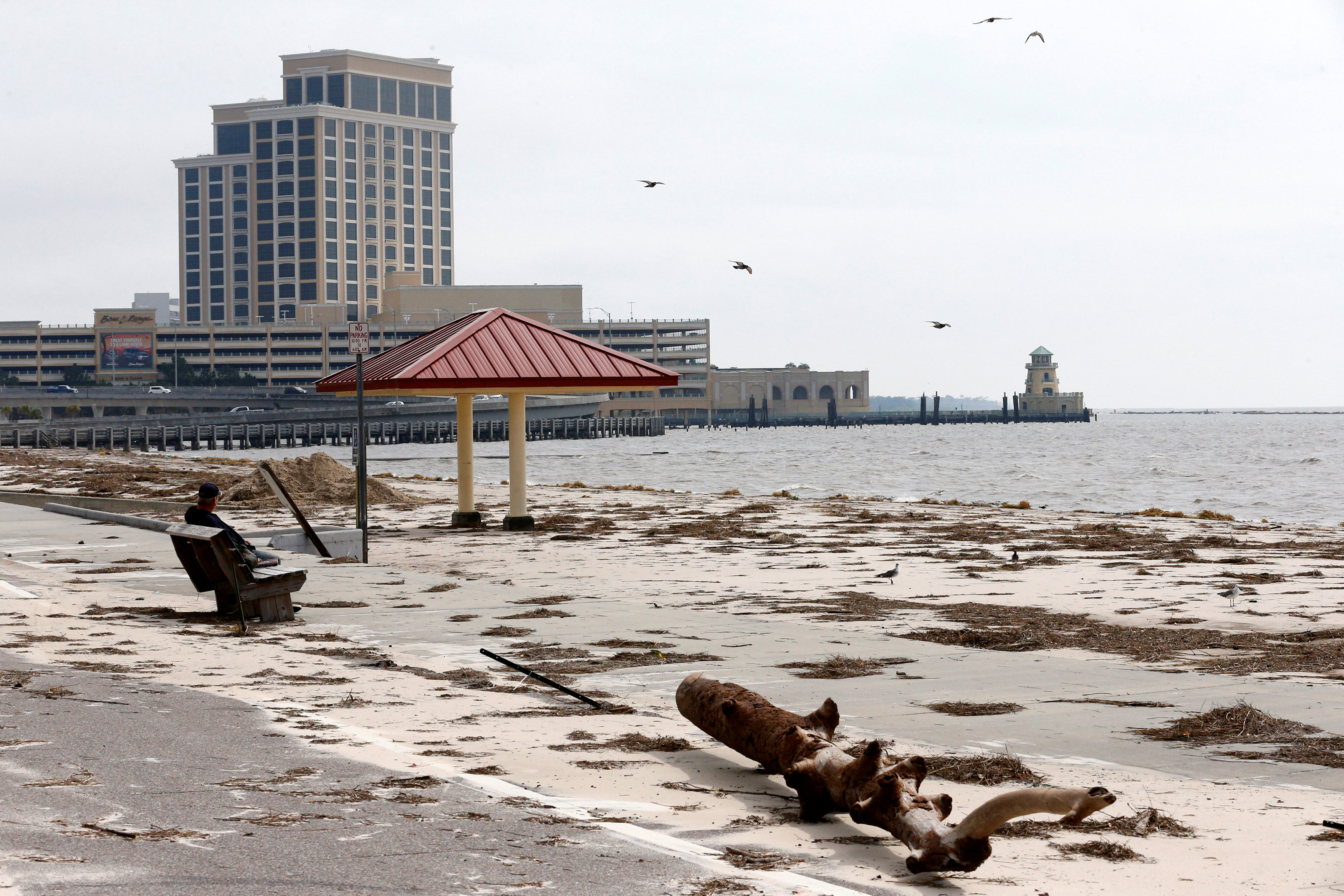
In Biloxi, water surged over roads during the storm and quickly receded on Sunday, leaving a boat that broke loose marooned on the beach. At a Waffle House restaurant, the storm surge deposited a dumpster in its parking lot.

Jeff Pickich, a 46-year-old wine salesman from D’Iberville, Mississippi, was counting his blessings. Heavy winds left only minor damage, blowing down part of a fence on his rental property in Biloxi.

“I’m just glad,” he said, digging fresh holes for fence posts. “I was afraid of the water. The water is Mother Nature. You can’t stop it.”

Water flowed through Ursula Staten’s yard in Biloxi, pushing over part of her fence and scattering debris, but did not breach her house.

“I have a mess,” the retired massage therapist said. “If we had got Irma, I would have lost everything.”

At the Golden Nugget Casino, one of eight Biloxi gaming establishments, workers rushed to clean up mud, debris and minor damage from 3 feet (1 m) of water sloshing into an entrance and the parkade. The gaming room stayed dry.

Three hundred guests remained in the hotel, some eager to try their luck after surviving Nate.

But dangers from the storm remain, with Florida Governor Rick Scott warning of tornadoes springing up in the Panhandle region and Alabama Governor Kay Ivey urging residents to prepare for strong winds and storm surges.

U.S. President Donald Trump declared federal emergencies in Alabama and Florida on Sunday, which provides additional funding for disaster relief.

Mississippi Power had restored electricity to 10,000 customers, but 4,800 were still without it. More than 1,000 people had arrived at shelters, the state Emergency Management Agency said.

Alabama Power said it had restored electricity to 58,000 of 146,000 customers who lost it.

Rainfall of 3 to 6 inches (8 to 15 cm), with a maximum of 10 inches (25 cm), was expected east of the Mississippi River in Alabama and Tennessee, the hurricane center said.

Residents walk down a street covered in debris scattered by Hurricane Nate, in Biloxi, Mississippi, U.S., October 8, 2017.

Residents walk down a street covered in debris scattered by Hurricane Nate, in Biloxi, Mississippi, U.S., October 8, 2017. REUTERS/Jonathan Bachman

NEW ORLEANS THREAT DOWNGRADED

Forecast at one point to make landfall in Louisiana, Nate headed farther east and spared many New Orleans parishes that were devastated by Hurricane Katrina 12 years ago.

“I had prayed for this – that we would be spared,” said Amos Cormier, president of Plaquemines Parish, Louisiana’s equivalent to a county.

Bernice Barthelemy, a 70-year-old Louisiana resident, died from cardiac arrest overnight after telling Reuters on Saturday that she did not mind having to evacuate, Cormier said on Sunday. He attributed her death to the stress of the move.

New Orleans Mayor Mitch Landrieu said he expected that evacuated residents could return home soon.

Vessel traffic and port operations at New Orleans resumed on Sunday afternoon, while the Port of Mobile in Alabama remained closed. Oil ports, producers and refiners in Louisiana, Mississippi and Alabama were planning reopenings as the storm moved inland on Sunday.

Heavy rain is seen at Orange Beach, Alabama, U.S. as Hurricane Nate approaches, on October 7, 2017 in this still image taken from a video obtained via social media. Jacob Kiper, Owensboro, KY/Social Media via REUTERS

Heavy rain is seen at Orange Beach, Alabama, U.S. as Hurricane Nate approaches, on October 7, 2017 in this still image taken from a video obtained via social media. Jacob Kiper, Owensboro, KY/Social Media via REUTERS

The storm curtailed 92 percent of daily oil production and 77 percent of daily natural gas output in the Gulf of Mexico, more than three times the amount affected by Harvey.

The storm doused Central America with heavy rains on Thursday, killing at least 16 people in Nicaragua, 10 in Costa Rica, two in Honduras and two in El Salvador.


(Reporting by Rod Nickel in Biloxi, Miss. and Jessica Resnick-Ault in Pascagoula, Miss.; Additional reporting by Marianna Parraga, Erwin Seba and Gary McWilliams in Houston; Jonathan Allen in New York; Writing by Lisa Shumaker; Editing by Lisa Von Ahn and Peter Cooney)


Thousands shelter as “screaming, howling” Cyclone Debbie hits north Australia

Strong wind and rain from Cyclone Debbie is seen effecting trees at Airlie Beach, located south of the northern Australian city of Townsville. AAP/Dan Peled/via REUTERS

By Tom Westbrook and Benjamin Weir

SYDNEY (Reuters) – Howling winds, heavy rain and huge seas pounded Australia’s northeast on Tuesday, damaging homes, wrecking jetties and cutting power to thousands of people as Tropical Cyclone Debbie tore through the far north of Queensland.

Wind gusts stronger than 260 km per hour (160 mph) were recorded at tourist resorts along the world-famous Great Barrier Reef as the storm made landfall as a category four, one rung below the most dangerous wind speed level.

It was later downgraded to category two. Forecasters said high winds would likely persist overnight, although the storm would then weaken rapidly and was expected to be downgraded to category one by dawn on Wednesday.

Police said one man was badly hurt when a wall collapsed at Proserpine, about 900 km (560 miles) northwest of the Queensland capital, Brisbane, and was taken to hospital.

But the weather was still too bad to assess damage fully or mount an emergency response.

“We will also receive more reports of injuries, if not deaths. We need to be prepared for that,” Queensland Police Commissioner Ian Stewart told reporters in Brisbane.

As the storm forged slowly inland after nightfall, state premier Annastacia Palaszczuk urged people to stay indoors.

“It is a serious event and we do not want to see loss of life,” she told the Australian Broadcasting Corp.

“It will be a difficult night for people across our state.”

Cyclone Debbie made landfall at Airlie Beach, north of Proserpine, shortly after midday local time (0200 GMT), knocking out telephone services.

“It’s very noisy: Screaming, howling wind … sounds like a freight train,” Jan Clifford told Reuters by text from Airlie Beach as the cyclone made landfall.

“Still blowing like crazy,” she said four hours later.

Authorities had urged thousands of people in threatened areas to flee their homes on Monday, in what would have been the biggest evacuation seen in Australia since Cyclone Tracy devastated the northern city of Darwin on Christmas Day, 1974.

CATASTROPHE DECLARED

Torrential rain flooded streets and wind smashed windows, uprooted trees and tossed debris down streets, while jetties at Airlie Beach marina were wrecked, Nine Network television pictures showed.

Power was cut for 48,000 people in a wide area between the towns of Bowen and Mackay, north and south of Airlie Beach, Ergon Energy spokesman John Fowler said.

Ports at Abbot Point, Mackay and Hay Point were shut and Townsville airport was closed. Airlines Qantas, Jetstar and Virgin Australia suspended flights to and from the region and said planes may also be grounded on Wednesday, although Townsville airport said it would reopen.

BHP Billiton and Glencore halted work at their coal mines in the storm’s path.

The Insurance Council of Australia declared Cyclone Debbie a catastrophe, making it easier to make claims, but said in a statement it was too early to estimate the cost of damage.

With an eye 50 km (30 miles) wide, the cyclone had earlier damaged tourist resorts, washed away beaches and tore boats from moorings as it swept through the Whitsunday islands, guests told Reuters by telephone.

Cyclone Debbie is the strongest storm to hit Queensland since Cyclone Yasi destroyed homes and crops and devastated island resorts in 2011.

Authorities had feared tidal surges in low-lying areas as the storm whipped up waves and currents and lifted sea levels, but said later that danger had eased.

Holidaymakers tried to make the best of it as they bunkered down in resort buildings. “Go to the Whitsundays they said, it’d be fun they said, beautiful weather over here,” holidaymaker Kurt Moore told the Sydney Morning Herald.

“I’m so glad we got evacuated out of the place we were staying at, I think we’d be pooping watermelons right now to be honest,” he said.

Despite issuing evacuation orders, police said they were not sure how many people had heeded their advice.

That did not deter some thrill-seeking bodyboarders who paddled out to surf in the heaving seas at Airlie Beach, television footage showed.

(Additional reporting by Byron Kaye; Editing by Paul Tait)

Severe Wind Storm Darkens Capitol

A surprise windstorm that hit Washington, D.C. knocked out power to the U.S. Capitol building and other landmarks.

Winds were gusting over 50 miles per hour as the temperature fell over 45 degrees during the day according to the National Weather Service.  The blast of colder air blacked out power to the Capitol Dome for half an hour in what officials called “a very rare event.”

Residents of West End reported their lights flickering and going out for the first time in years.

Utility companies say at the maximum outage, over 60,000 customers were without power across the region.

Midwestern Tornadoes Leave Six Dead

At least six people are confirmed dead after a Sunday outbreak of tornadoes across the Midwest.

The town of Washington, Illinois was devastated by a massive tornado that tore an 1/8th mile wide track through the entire town. Mayor Gary Manier said that up to 500 homes have been damaged or destroyed and that some neighborhoods are completely destroyed.

“How people survived is beyond me,” Manier said.

The tornadic storms are considered unusual for mid-November. Damaging winds and tornadoes were reported in 12 states: Michigan, Iowa, Illnois, Wisconsin, Indiana, Ohio, Kentucky, Missouri, Tennessee, West Virginia, Pennsylvania and New York.

The storms moved so fast at times that weather forecasters were warning people to see shelter even before they could see a change in the weather.

The storm threatened the Chicago area forcing the game between the NFL’s Chicago Bears and Baltimore Ravens to be delayed for two hours as teams and spectators huddled under the stadium.