Hawaii volcano eruption slows to virtual halt after more than three months

FILE PHOTO: Lava erupts in Leilani Estates during ongoing eruptions of the Kilauea Volcano in Hawaii, U.S., June 5, 2018. REUTERS/Terray Sylvester

By Steve Gorman

(Reuters) – The destructive lava eruption at the foot of Kilauea Volcano on the Big Island of Hawaii has slowed to a virtual halt in recent days for the first time in over three months, geologists said on Monday, although it was too soon to tell what might happen next.

The lone volcanic fissure that was still active last week has dwindled from a fountain of molten rock to a bubbling pond of lava no longer spilling out of the blackened cone surrounding it, said Tina Neal, chief scientist at the U.S. Geological Survey’s Hawaiian Volcano Observatory.

Levels of sulfur dioxide gas vented from the fissure, located on the lower east flank of Kilauea, about 25 miles (40 km) from its summit crater, have also dropped dramatically, she said.

The subdued activity there coincided with another major collapse in the outer wall of the summit crater last Thursday, followed by a final flurry of earthquakes before the peak of the volcano grew still.

“The system appears to have almost shut down completely over the course of a couple of days,” Neal told reporters on a conference call. She said it was “all consistent with something turning off the spigot to the surface.”

At this point, the volcanic reservoir at the bottom of the summit crater appeared “significantly drained” of magma – the term for molten rock before it erupts – that was feeding the lava vents downslope at the surface.

At the height of Kilauea’s current eruption, which began on May 3, a total of two dozen fissures had opened in the ground at the foot of the volcano, in an area scientists call the lower east rift zone. But only one vent, dubbed Fissure 8, was still active last week.

It was a river of lava from Fissure 8 that had crept eastward to the ocean, engulfing two seaside housing developments before pouring into the Pacific. Hundreds more dwellings have been swallowed closer to the eruption site.

FILE PHOTO: Lava fragments falling from lava fountains at fissure 8 are building a cinder-and-spatter cone around the erupting vent, with the bulk of the fragments falling on the downwind side of the cone as it continues to feed a channelized lava flow that reaches the ocean at Kapoho during ongoing eruptions of the Kilauea Volcano in Hawaii, U.S. June 11, 2018. USGS/Handout via REUTERS

FILE PHOTO: Lava fragments falling from lava fountains at fissure 8 are building a cinder-and-spatter cone around the erupting vent, with the bulk of the fragments falling on the downwind side of the cone as it continues to feed a channelized lava flow that reaches the ocean at Kapoho during ongoing eruptions of the Kilauea Volcano in Hawaii, U.S. June 11, 2018. USGS/Handout via REUTERS

The property losses marked the most destructive eruption event of Kilauea or any other volcano in Hawaii’s recorded history.

Neal said it remains to be seen whether the reduced flow at Fissure 8 will turn out to be a brief pause or an extended lull, or whether other vents will reactivate. A similar 88-day eruption in the lower east rift zone in 1955 was punctuated by one pause of five days and one lasting 16 days, Neal said.

Neal said scientists would be surprised if the summit crater produced any new major eruptions in the near future.

The current shift in volcanic activity happened as Hurricane Hector churned across the Pacific toward Hawaii, with forecasters predicting it would skirt past the southern coast of the Big Island on Wednesday.

Neal said the storm would have no effect on the volcano, except for the possibility of large steam clouds producing “white-out” conditions in areas where heavy rain falls on top of molten lava that has yet to thoroughly cool.

(Reporting by Steve Gorman in Los Angeles; Editing by Paul Tait)

Vertical plume of ash explodes from Hawaii volcano, hundreds ordered to leave vicinity

Volcanic gases rise from the Kilauea lava flow that crossed Pohoiki Road near Highway 132, near Pahoa, Hawaii, U.S., May 28, 2018. REUTERS/Marco Garc

HONOLULU (Reuters) – A small explosion of ash erupted from the summit of Hawaii’s Kilauea volcano early on Tuesday morning in a vertical plume some 15,000 feet (4,600 meters) high, the U.S. Geological Survey said, the latest outburst in a month of volcanic activity.

The agency warned that ash was drifting northwest and liable to dust anyone in the summit area. Hundreds of people have been ordered to leave the vicinity of the biggest eruption cycle in a century of one of the world’s most active volcanoes.

A news reporter takes pictures of the Kilauea lava flow that crossed Pohoiki Road near Highway 132, near Pahoa, Hawaii, U.S., May 28, 2018. REUTERS/Marco Garcia

A news reporter takes pictures of the Kilauea lava flow that crossed Pohoiki Road near Highway 132, near Pahoa, Hawaii, U.S., May 28, 2018. REUTERS/Marco Garcia

Multiple fissures continue to spew up hot lava flows, which have blocked roads and damaged dozens of buildings on Hawaii’s Big Island.

One fountain of lava rose more than 200 feet (60 meters) at times on Monday, the Geological Survey said.

Officials are on high alert for occasional earthquakes, though none have been big enough so far to trigger a tsunami.

Lava has engulfed the heads of two wells that tap into steam and gas deep in the Earth’s core at the 38-megawatt Puna Geothermal Venture. Its operator, Israeli-controlled Ormat Technologies Inc, said it had not been able to assess the damag

So far no deaths have been blamed on the eruption, though a man’s leg was shattered when he was hit by a spatter of super-dense lava.

Residents fear the wells may be explosive. Officials have said the power plant is safe but lava has never engulfed a geothermal plant anywhere in the world, creating a measure of uncertainty.

Contingency plans have been made for a possible helicopter evacuation of up to 1,000 residents in a coastal area south of the fissures should their last exit route, be blocked by lava or become unsafe due to gaping cracks, County of Hawaii officials said.

At least 82 homes have been destroyed in the southeastern corner of Big Island and about 2,000 people have been ordered evacuated since Kilauea began erupting on May 3.

(Reporting by Jolyn Rosa; writing and additional reporting by Jonathan Allen; Editing by Scott Malone and Jonathan Oatis)

Lava covers potentially explosive well at Hawaii geothermal plant

Lava from the Kilauea volcano shoots out of a fissure, in the Leilani Estates near Pahoa, May 26, 2018. REUTERS/Marco Garci

By Jolyn Rosa

HONOLULU (Reuters) – Lava from Hawaii’s erupting Kilauea volcano has covered a potentially explosive well at a geothermal power station and threatened another, after flowing onto the site, officials said.

The Hawaii Civil Defense Agency said the wells “are stable and secure”, and Hawaii Governor David Ige said that the plant was “sufficiently safe” from the lava that has plowed through backyards and streets and burned dozens of homes.

But lava has never engulfed a geothermal plant anywhere in the world and the potential threat is untested, according to the head of the state’s emergency management agency. Local residents fear an explosive emission of deadly hydrogen sulfide and other gases should wells be ruptured.

The molten rock was expected to continue to flow across the Puna Geothermal Venture (PGV) facility, according to the U.S. Geological Survey.

Lava flows are seen entering the sea along the coastline during ongoing eruptions of the Kilauea Volcano May 23, 2018. USGS/J. Ozbolt, Hilo Civil Air Patrol/Handout via REUTERS

Lava flows are seen entering the sea along the coastline during ongoing eruptions of the Kilauea Volcano May 23, 2018. USGS/J. Ozbolt, Hilo Civil Air Patrol/Handout via REUTERS

Since Hawaii’s Kilauea volcano began a once-in-a-century-scale eruption on May 3, authorities have shutdown the plant, removed 60,000 gallons of flammable liquid, and deactivated wells that tap into steam and gas deep in the Earth’s core.

Magma has drained from Kilauea’s summit lava lake and flowed around 25 miles (40 km) east underground, bursting out of about two dozen giant cracks or fissures near the plant.

The Israeli-owned 38 megawatt plant typically provides around 25 percent of electricity on the Big Island, according to local power utility Hawaii Electric Light.

Operator Ormat Technologies Inc last week said there was no above-ground damage to the plant, but it would have to wait until the situation stabilized to assess the impact of earthquakes and subterranean lava flows on the wells.

Over the weekend, there were more than 250 earthquakes at Kilauea’s summit, with four explosions on Saturday sending ash as high as 12,000-15,000 feet, officials said.

Winds are set to shift on Monday and Tuesday, causing higher concentrations of ash and volcanic smog that will spread west and northwest to affect more populated areas, said National Weather Service meteorologist John Bravender.

Onlookers gather at the foot of the lava bed, as a lava shoots molten rock into the air, in the Leilani Estates near Pahoa, May 27, 2018. REUTERS/Marco Garcia

Onlookers gather at the foot of the lava bed, as a lava shoots molten rock into the air, in the Leilani Estates near Pahoa, May 27, 2018. REUTERS/Marco Garcia

U.S. Marine Corps and National Guard helicopters are on standby for an air evacuation if fissure activity cuts off Highway 130, the last exit route for up to 1,000 coastal residents.

More residents in some sections of the Leilani Estates neighborhood were ordered to immediately evacuate shortly before 8 p.m. “due to a fast moving lava flow from Fissure 7”, a statement from the civil defense agency said.

Officials had no information on how many residents still remained in the neighborhood or how many people might have already left. Local media has reported that about 2,000 people have already evacuated since the new eruptions began.

(Reporting by Joyln Rosa in Honolulu; Additional reporting by Rich McKay in Atlanta; Editing by Darren Schuettler and Alison Williams)

U.S. Chemical Safety Board urges chemical plants to weigh disaster risks

FILE PHOTO: The flooded plant of French chemical maker Arkema SA, which produces organic peroxides, is seen after fires were reported at the facilty after Tropical Storm Harvey passed in Crosby, Texas, U.S. August 31, 2017. REUTERS/Adrees Latif

HOUSTON (Reuters) – The U.S. Chemical Safety Board on Thursday urged chemical plants to weigh the risks of natural disasters just as they would the integrity of pipes and production equipment.

“Such facilities should perform an analysis to determine their susceptibility to extreme weather events,” the board said in its final report on a chemical fire at the Arkema SA plant in Crosby, Texas, during Hurricane Harvey in August and September 2017.

“In addition, companies should assess seismic hazard maps to determine the risk of earthquakes and consider the risk of other extreme weather such as high-wind events,” the board said in the report.

Harvey dropped five feet of water on the Crosby plant, cutting off power to low-temperature warehouses meant to keep cool organic peroxides used in plastics production.

The peroxides were placed in refrigerated trailers as a last resort to keep them from decomposing and catching fire at the plant located 27 miles east of Houston.

FILE PHOTO: A fire burns at the flooded plant of French chemical maker Arkema SA after Tropical Storm Harvey passed in Crosby, Texas, U.S. August 31, 2017. REUTERS/Adrees Latif

But when flood waters cut power to the trailers, the peroxides decomposed, heated up and caught fire, forcing the evacuation of 200 people living within a 1.5 mile radius of the plant. Twenty-one people sought treatment for exposure to fumes from the blaze.

The evacuation ended after officials set fire to the storage trailers to burn up all of the peroxides.

The board, which has no enforcement or regulatory authority, recommended Arkema develop plans for flood risks at its plants and put in place multiple, redundant systems for storing chemicals.

The CSB also recommended that the American Institute of Chemical Engineers’ Center for Process Safety develop guidelines so plants can evaluate risk from extreme weather.

The board said Harris County, Texas, should update training and protective equipment to emergency responders to prevent exposure to hazardous chemicals.

Many of those exposed to the fumes from the fire were emergency responders.

(Reporting by Erwin Seba; Editing by Bernadette Baum)

Hawaii volcano spews 6 mile-high plume of ash, could blow again

Lava spattering area from an area between fissures 16 and 20 is seen in Hawaii, U.S. May 16, 2018. Picture taken on May 16, 2018. USGS/Handout via REUTERS

By Terray Sylvester

PAHOA, Hawaii (Reuters) – Hawaii’s Kilauea volcano spewed ash nearly six miles (9 km) into the sky on Thursday and scientists warned this could be the first in a string of more violent explosive eruptions with the next possibly occurring within hours.

“This has relieved pressure temporarily,” U.S. Geological Survey geologist Michelle Coombs told a news conference in Hilo. “We may have additional larger, powerful events.”

Residents of the Big Island were warned to take shelter from the ash as toxic gas levels spiked in a small southeast area where lava has burst from the ground during the two-week eruption.

The wind could carry Kilauea’s ash plume as far as Hilo, the Big Island’s largest city and a major tourism center, the County of Hawaii Civil Defense warned in an alert.

A person is silhouetted against the light from lava in Pahoa, Hawaii, U.S., May 17, 2018 in this picture obtained from social media on May 18, 2018. KRIS BURMEISTER/via REUTERS

A person is silhouetted against the light from lava in Pahoa, Hawaii, U.S., May 17, 2018 in this picture obtained from social media on May 18, 2018. KRIS BURMEISTER/via REUTERS

“Protect yourself from ash fallout,” it said.

Some Big Island residents had feared “the big one” after Kilauea shot anvil-sized “ballistic blocks” into the visitors’ car park on Wednesday and was rocked by earthquakes that damaged buildings and cracked roads in the park that was closed last week.

But geologists said the 4:15 a.m. (10:15 a.m. EDT) explosion was not particularly large and on a par with the last series of steam-driven blasts, which took place in 1924.

“The activity is such that they can occur at any time, separated by a number of hours,” Hawaiian National Volcano Observatory Deputy Scientist-In-Charge Steve Brantley told reporters on a conference call.

Geologists said it was extremely unlikely Kilauea would have a massive eruption like that of 1790 which killed dozens of people in the deadliest eruption to occur in what is now the United States.

Kilauea’s falling lava lake has likely descended to a level at or below the water table, allowing water to run on to the top of its lava column and create steam-driven blasts, they said.

“I don’t think there is a big one that’s coming,” said University of Hawaii vulcanologist Scott Rowland.

“I think it’s going to be a series of explosions similar to the one that happened this morning, and that’s based on what happened in 1924, which is really our only analog,” he said of the nearly century old event, which lasted 2-1/2 weeks and killed one person who was hit by a “ballistic block.”

On Thursday, a 21st fissure also opened in Leilani Estates while other fissures reactivated with lava, the Hawaii Civil Defense said in an alert.

People wait in line for free dust masks in Keaau to protect themselves from volcanic ash during ongoing eruptions of the Kilauea Volcano in Hawaii, U.S., May 17, 2018. REUTERS/Terray Sylvester

People wait in line for free dust masks in Keaau to protect themselves from volcanic ash during ongoing eruptions of the Kilauea Volcano in Hawaii, U.S., May 17, 2018. REUTERS/Terray Sylvester

ASH MASKS

A spike in toxic sulfur dioxide gas levels closed schools around the town of Pahoa, 25 miles (40 km) east of the volcano, where lava from giant cracks has destroyed 37 homes and other structures and forced about 2,000 residents to evacuate.

A change in wind direction caused gas spewing from fissures to drift northwest towards Pahoa, prompting National guard troops to don gas masks at a nearby road intersection, according to a Reuters reporter.

Pahoa fire station recorded a “red level” of sulfur dioxide, meaning the gas would cause choking and an inability to breathe, Fenix Grange of the Hawaii Department of Health told a news conference in Hilo.

“If it’s red, it’s get out of Dodge,” she said.

There have been no deaths or serious injuries reported during the current eruption.

Civil defense workers handed out one ash mask per family member in communities close to Kilauea to protect residents from the powdered rock, which is not poisonous but causes irritation to eyes and airways.

Volunteers handed out some 5,000 dust masks in less than three hours in the community of Kea’au, north of Pahoa at one of the four distribution points that were opened on Thursday.

“It was just thick, eyes watering kinda stuff,” said Glenn Severance, 65, a resident of Hawaii Paradise Park.

“I just wanted to have something,” said Severance, adding he knew the mask would not protect against toxic volcanic gases.

An aviation red alert was in effect due to risks ash could be carried into aircraft routes and damage jet engines, USGS said. Passenger jets generally cruise at around 30,000 feet, the height of Thursday’s plume.

A geologist inspects cracks on a road in Leilani Estates, following eruption of Kilauea volcano, Hawaii May 17, 2018. United States Geological Survey (USGS)/Handout via REUTERS

A geologist inspects cracks on a road in Leilani Estates, following eruption of Kilauea volcano, Hawaii May 17, 2018. United States Geological Survey (USGS)/Handout via REUTERS

Across the Big Island, home to 200,000 residents, people were encouraged to take caution driving, as ashfall can make roads slippery, and not go outdoors unless necessary.

But by 1:30 p.m. (7:30 p.m. EDT) reported ashfall was limited to only light, wet deposits about 3-4 miles (5-6 km) northwest of the summit, as rain over the volcano curbed the spread of ash.

Thursday’s eruption lasted only a few minutes, said Coombs who called it “a big event that got people’s attention, but did not have widespread impact”.

“Tall but small,” she said of Thursday’s plume.

(Additional reporting by Jolyn Rosa in Honolulu; Writing by Andrew Hay; Editing by Bill Tarrant, Sandra Maler and Himani Sarkar)

Toxic gas alert for Hawaii volcano eruption; new areas at risk

Deposits are seen on a road in Puna, Hawaii. Apau Hawaii Tours/via REUTERS

By Terray Sylvester

PAHOA, Hawaii (Reuters) – Residents on the Big Island of Hawaii were alerted on Thursday to rising levels of toxic gas from lava-oozing fissures, and geologists warned that new areas east of the erupting Kilauea volcano may be at risk of molten rock bursting from the ground.

Hawaii County authorities sent a text message to residents of the southeast corner of the island warning them of a wind change that would bring rising levels of sulfur dioxide gas, which can be fatal if inhaled in large quantities.

“It’s just horrible. You can’t breathe in there,” said evacuated resident Robynn Stagg, 58, who drove through the thick, orange sulfur dioxide haze earlier this week in a failed attempt to check on her home.

Hawaii’s governor has warned that mass evacuations may be required as more fissures open in the ground and spew lava and gas into semi-rural residential areas on the east flank of Kilauea, one of the world’s most active volcanoes.

During an evening meeting with community members, an official with the United States Geological Survey’s Hawaii Volcano Observatory said that while no new fissures have opened during the last 24 hours, there has been “quite a bit” of ground cracking over the last day and that they were releasing steam.

“Because the lava intrusion is still active and earthquakes are still occurring, we still think there’s a decent chance of new eruptive activity at the surface,” Steven Brantley said.

Authorities on Thursday completed the removal of highly flammable chemicals from a nearby geothermal power plant that was in the path of creeping lava.

The latest upheaval at Kilauea began last week after the crater floor of a long-active side vent collapsed suddenly in a cloud of ash, triggering a similar plunge in the molten lake inside the larger crater at the volcano’s summit.

What followed was a flurry of earthquakes as huge volumes of magma — the term for lava beneath the surface — drained back through deep-underground passages that carried the molten rock far downslope. The lava then forced its way back to the surface through large cracks, or fissures, that opened at ground level in a residential area miles (km) a

‘BALLISTIC BLOCKS’

Geologists said Kilauea may be entering a new phase of explosive eruptions not seen in nearly a century that could hurl “ballistic blocks” weighing up to 12 tons for half a mile (800 meters), and rain pebble-sized fragments for another mile or two (1.8 to 3.2 km).

However, the immediate vicinity around the summit, an area controlled by the National Park Service, was to be closed to visitors indefinitely, starting on Thursday night.

Such blasts would likely also eject plumes of volcanic ash that could be carried farther downwind into neighboring communities, creating a nuisance and potential respiratory irritant, but not a life-threatening hazard, officials said.

The Leilani Estates community remains in greatest danger, with 15 volcanic fissures so far having destroyed 36 structures, most of them homes, and forcing the evacuation of about 2,000 residents.

But as the eruption progresses, “other areas of the lower East Rift Zone may also be at risk,” the Hawaiian Volcano Observatory said in a bulletin.

“There is the potential for additional outbreaks,” Christina Neal, the chief scientist at the U.S. Geological Survey’s Hawaiian Volcano Observatory at Kilauea told a news briefing. “There are other communities, other residential neighborhoods that could, depending on the evolution of activity, be in harm’s way.”

Hawaii Governor David Ige has requested federal disaster assistance as he said a mass evacuation of the lower Puna District, where Leilani Estates is located, would be beyond current county and state capabilities.

Hawaii police said they arrested Alexandru Stingu-Dragomir, 29, on suspicion he burgled four houses in Leilani Estates after the mayor declared an emergency the area on last week.

SURFING IN THE VOG

Local meteorologists said the change in prevailing winds could send Kilauea’s volcanic smog, or vog, northwest to Maui and other islands in Hawaii.

Surfers bobbing in the ocean off Kona on the west side of the Big Island complained of the smog that could be seen in a haze over the coast.

“Does that hat protect against vog?” one surfer was heard quipping to another about the floppy sun hat he was wearing.

In Pahoa, the nearest village to Kilauea, some schools remained closed after the area was hit by a 6.9 magnitude earthquake on Friday, the biggest since 1975.

The closures have added to a sense of disarray and ramped up stress levels, said gallery owner Amedeo Markoff, 49.

“It’s like our version of a snow day — a lava day,” joked Markoff.

(Reporting by Terray Sylvester and Jolyn Rosa; Writing and additional reporting by Andrew Hay in New Mexico; Editing by Bill Tarrant and Sandra Maler)

Fissures spread from Hawaii volcano, threatening more homes

Lava is seen from a fissure appearing behind a resident's backyard in Puna, Hawaii, U.S. in this still frame taken from May 6, 2018 video obtained from social media. KEITH BROCK/Social Media via REUTERS

By Terray Sylvester

PAHOA, Hawaii (Reuters) – Emergency crews said they were poised to evacuate more people as fissures kept spreading from Hawaii’s erupting Kilauea volcano, five days after it started exploding.

Around 1,700 people have already been ordered to leave their homes after lava crept into neighborhoods and deadly volcanic gases belched up through cracks in the earth.


Lava engulfs a Ford Mustang in Puna, Hawaii, U.S., May 6, 2018 in this still image obtained from social media video. WXCHASING via REUTERS

Lava engulfs a Ford Mustang in Puna, Hawaii, U.S., May 6, 2018 in this still image obtained from social media video. WXCHASING via REUTERS

The evacuation zone could now grow as fissures are spreading into new areas on the eastern side of the Big Island, Hawaii Civic Defense Administrator Talmadge Magno told a community meeting

“If things get dicey, you got to get out,” he said. “If you live in the surrounding communities … be prepared. Evacuation could come at any time.”

Kilaueax has opened 12 volcanic vents since it started sending out fountains and rivers of lava on Thursday, officials said. Lava was not flowing from any of the vents on Monday.

Resident Heide Austin said she left her home just west of the current eruption zone after noticing small cracks appearing at the end of her driveway.

One eruption near her home “sounded like a huge blowtorch going off,” said the 77-year-old who lives alone. “That’s when I really got into a frenzy.”

Many of the evacuated people were permitted to return home during daylight hours on Sunday and Monday, during a lull in seismic activity.

Residents of a second area, Lanipuna Gardens, were barred from returning home on Monday due to deadly volcanic gases.

Leilani Estates, about 12 miles (19 km) from the volcano, was evacuated due to the risk of sulfur dioxide gas, which can be life threatening at high levels.

Puna district residents attend a community meeting during ongoing eruptions of the Kilauea Volcano at Pahoa High and Intermediate School in Pahoa, Hawaii, U.S., May 7, 2018. REUTERS/Terray Sylvester

Puna district residents attend a community meeting during ongoing eruptions of the Kilauea Volcano at Pahoa High and Intermediate School in Pahoa, Hawaii, U.S., May 7, 2018. REUTERS/Terray Sylvester

No deaths or major injuries have been reported. At least 35 structures had been destroyed, many of them homes, officials said.

The southeast corner of the island was rocked by a powerful magnitude 6.9 earthquake on the volcano’s south flank on Friday. More earthquakes and eruptions have been forecast.

Kilauea, one of the world’s most active volcanoes, has been in constant eruption for 35 years.

(Reporting by Terray Sylvester; Editing by Andrew Heavens)

Matthew 24: 6-8 – A current statistic point of view

An American flag flies near the base of the destroyed World Trade Center in New York on September 11 2001

By Kami Klein

“If you want to know the future you must know the Word of the Living God.”       Jim Bakker

In every moment, the events that Jesus spoke of are evident all around us.  In the vastness of this world, it is sometimes difficult to see the big picture of what is happening NOW!  We must keep our eyes and ears open.

Matthew 24:6-8 (MEV) You will hear of wars and rumors of wars. See that you are not troubled. For all these things must happen, but the end is not yet. 7 For nation will rise against nation, and kingdom against kingdom. There will be famines, epidemics, and earthquakes in various places. 8 All these are the beginning of sorrows.

NATION WILL RISE AGAINST NATION, KINGDOM AGAINST KINGDOM –FROM GLOBAL CONFLICT TRACKER –   Total of 25 conflicts in the world.  Below are listed most significant to U.S. and linked to the history of each conflict 

  • Critical impact on U.S. Interests

Civil War in Syria -Iran, Russia and Turkey’s deeper involvement- recent Chemical weapons attacks

War against Taliban in Afghanistan

Territorial Disputes in the South China Sea

Tensions in the East China Sea

North Korea Crisis

War Against Islamic State in Iraq

  • Significant Impact on U.S. Interests

Israeli-Palestinian Conflict

Political Instability in Lebanon

Instability in Egypt

Conflict between Turkey and armed Kurdish groups

Islamist Militancy in Pakistan

Conflict in Ukraine

Criminal Violence in Mexico

Boko Haram in Nigeria

Conflict between India and Pakistan

Civil War in Libya

War in Yemen

Great humanitarian concerns Rohingya crisis in Myanmar, Somalia, South Sudan Civil War, Destabilization of Mali, extreme violence in Central African Republic and Democratic Republic of Congo.

THERE WILL BE FAMINE – Global report on Current hunger crisis – March 2018 report

Around 124 million people in 51 countries face Crisis food insecurity or worse

This is an increase of 11 million people – an 11 percent rise in the last year – in the number of food-insecure people needing urgent humanitarian action across the world.

Last year’s Global Report on Food Crises identified 108 million people in Crisis food security or worse across 48 countries. The rise in numbers are attributed to increasing instability and conflict as well as drought and very poor harvests. Some countries are suffering from economic conditions that contribute to the malnutrition of their people. The country of Venezuela is now suffering from  lack of food sources or money to purchase necessary food and medicine. Thousands are fleeing to neighboring countries to feed their families. 

Approx. 21,000 people die each day, one every four seconds, of malnutrition

Forty percent of preschool-age children who suffer from malnutrition are estimated to be anemic because of iron deficiency, and anemia causes 20 percent of all maternal deaths. In addition, it is estimated that 250 to 500 thousand children go blind from Vitamin A deficiency every year.

EPIDEMICS 

Germs with Unusual Antibiotic Resistance Widespread in U.S- (From CDC Press release April 3rd, 2018)Health departments working with CDC’s Antibiotic Resistance (AR) Lab Network found more than 220 instances of germs with “unusual” antibiotic resistance genes in the United States last year, according to a CDC Vital Signs report released today.

FLU – As of the end of February 2018 4,000 people a week in the U.S. were dying of Flu and Pneumonia according to U.S. Center for Disease Control

The levels of influenza-like illnesses being reported for the 2017-2018 flu season are as high as the peak of the swine flu epidemic in 2009, and exceed the last severe seasonal flu outbreak in 2003 when a new strain started circulating, said Anne Schuchat, the U.S. Centers for Disease Control and Prevention’s acting director. Swine flu, which swept the globe in 2009 and 2010, sickened 60.8 million Americans, hospitalized 274,304 and killed 12,469, according to CDC data. Deaths from the current outbreak will likely far outstrip those of the 2009-2010 season.  It is April and the Flu season continues.

AIDS –AIDS is now second only to the Black Death as the largest epidemic in history. (From the World Health Organization) Aids or HIV was originated with non human primates (monkeys) in Central and West Africa

AIDS kills roughly 1.5 million people a year, or about one person every 20 seconds.

MALARIA  –Approximately a half million people die from malaria each year and many millions more are seriously weakened by it. Malaria is spread by mosquitoes.

CHOLERABetween 42,000 and 142,000 people die of cholera each year.  You can get cholera by eating or drinking contaminated water or food.

LASSA FEVER– Lassa fever, a viral hemorrhagic fever with symptoms similar to those of Ebola virus disease.  This disease is spread through contact with Rat feces and urine. Originated in West Africa. This year has generated more severe and fatal cases.  Usually an estimated 300,000 people are infected with the virus annually, with up to 5,000 deaths. But this year the fatality rate has gone to 50% of those infected.  

AND EARTHQUAKES IN VARIOUS PLACES

According to the USGS there have been 42 ‘significant earthquakes since January 1st, 2018. A significant earthquake is determined by a combination of magnitude, number of Did You Feel It responses, and PAGER alert level.  Those that have been counted are earthquakes above 4.2.  12 were in the U.S. The largest was a 7.9 in Alaska on 1-23-18.

227 people have died around the world.  For the last 365 days the total for all measurable earthquakes around the world has been 40,561.

Currently there are 33 erupting volcanoes and 55 that are having minor activity or have an impending warning issued.  


Shakes and superstition: Exxon faces backlash in Papua New Guinea

FILE PHOTO: The ExxonMobil Hides Gas Conditioning Plant process area is seen in Papua New Guinea in this handout photo dated March 1, 2018. ExxonMobil/Handout via REUTERS/File Phot

By Jonathan Barrett and Henning Gloystein

SYDNEY/SINGAPORE (Reuters) – A deadly earthquake that struck ExxonMobil’s $19 billion gas project in the mountains of Papua New Guinea is sparking a backlash against the U.S. energy giant that could prove harder to fix than buried roads and broken pipes.

Some spooked locals blame Exxon <XOM.N> and its project partners of causing, or at least magnifying, the 7.5 magnitude quake on Feb. 26 and a series of intense aftershocks that continue to pound the impoverished and isolated region.

While firmly denied by Exxon and debunked by geologists, the accusations suggest that the project known as PNG LNG, one of the most successful liquefied natural gas (LNG) developments in the world, is sorely lacking goodwill from at least parts of the local population.

The concerns about the project – the country’s biggest revenue earner – are even being expressed at senior levels in the Papua New Guinea government.

PNG’s Vice Minister for Petroleum and Energy, Manasseh Makiba, told Reuters in a phone interview there should be an inquiry to respond to local concerns that mother nature had reacted after the ground was disturbed by drilling.

Graphic on Papua New Guinea’s earthquakes and aftershocks: http://reut.rs/2tq3zY6

“It could be man-made but that cannot be confirmed until a proper scientific inquiry can be done,” said Makiba, who represents parts of the quake-hit area. “We need to resolve that.”

PNG’s Minister for Finance James Marape has also demanded answers from the company.

“In a world of science and knowledge, I now demand answer(s) from Exxon and my own government as to the cause of this unusual trend in my Hela,” wrote Marape on his private feed on Facebook, referring to the quake-struck province.

He is among many who have lit up social media in PNG, with blogs and Facebook posts pointing the finger at the oil and gas sector’s alleged contribution to the disaster.

Around Exxon’s operation, communities remain fearful as the death toll climbs, with 18 more killed by a 6.7 magnitude aftershock on Wednesday.

Papua New Guinea straddles the geologically active Pacific Ring of Fire.

Chris McKee, acting director of the Geohazards Management Division in Port Moresby, said there was no link between the project and seismic activity, which has included more than 120 quakes of magnitude 4.5 and greater in the week after the initial hit.

Graphic on Papua New Guinea government revenue and LNG income – http://reut.rs/2D3KAlP

“Earthquake activity has been going on much longer than the oil and gas industry presence in the region – there is no connection at all,” McKee said.

Scientific evidence strongly suggests the earthquake was “naturally occurring and consistent with prior events”, an Exxon spokeswoman said in a statement.

CORPORATE SUPPORT

Led by Exxon, with a one-third stake, and its Australian partners Oil Search <OSH.AX> and Santos <STO.AX>, PNG LNG could be shut for months as it inspects pipelines, the processing plant and the gas field for damage.

Exxon said it was giving $1 million to assist communities affected by the earthquake and was providing on-the-ground support to relief agencies so that resources could reach areas in greatest need.

“Logistics remains a challenge with roads cut and communication with remote communities difficult,” a company spokeswoman said. “We are continuing to provide logistics and human resources to help aid agencies to deliver support to our communities for the long term as they recover from this event.”

Oil Search Managing Director Peter Botten said he had not witnessed any local animosity toward the LNG project. Oil Search was constantly balancing the need for relief aid and keeping the community-sustaining business going when allocating post-quake resources, he said.

Graphic on share price performance of oil majors – http://reut.rs/2FeHCRw

“There’s a lot of concern the gods have been offended and specifically this is about education, and what earthquakes are about,” Botten told Reuters in a phone interview from PNG’s capital Port Moresby. “This is a communication issue.”

Most of the nations 8 million inhabitants live in remote communities where traditional beliefs remain strongly held.

SHAKY GROUND

Exxon has previously faced resentment in PNG, which contains vast natural resources but remains desperately poor.

Martyn Namorong, national coordinator for landowner rights and governance lobby group PNG Resource Governance Coalition, said the quake had reawakened concerns raised in 2012 when a landslide tore through a quarry used by Exxon, killing at least 25 people.

“It’s not just a localized thing or an ignorant thing. People are wondering what might be the contributing factor of oil and gas extraction,” said Namorong, referring to the quake.

Exxon said at the time it had closed the Tumbi quarry five months before the landslide.

“Tumbi was a tragic event that had its own unique set of circumstances,” Exxon told Reuters in an email, without elaborating.

Concerns flared again last year when the oil major had to evacuate staff due to unrest in Hela province, where the project’s Hides Gas processing unit is located.

The trouble was linked to national elections and disputes over royalties from the PNG LNG project, which generates around $3 billion in sales per year at current LNG prices.

“PEOPLE ARE TERRIFIED”

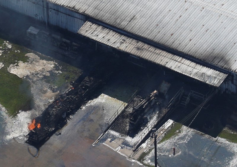
The earthquake forced a closure of the Hides Gas processing facility which feeds a 700-km (435 miles) pipeline snaking through the jungle to the LNG plant and export terminal near Port Moresby.

The disruption in Papua New Guinea comes shortly after Exxon reported disappointing results, with PNG LNG a rare bright spot. Its shares have underperformed compared with its main competitors Royal Dutch Shell, Chevron, BP  and Total.

“PNG LNG had reportedly been running at a very healthy 20 percent above nameplate capacity… There will be some hit to the PNG industry,” said Readul Islam, research analyst at consultancy Rystad Energy.

If repairs take long, the quakes could even delay plans with France’s Total to double output to around 16 million tonnes per annum at an estimated cost of $13 billion.

The companies plan to add three new LNG units, or trains, with two underpinned by gas from the Elk-Antelope fields, run by Total, and one underpinned by existing fields and a new Exxon-run field.

Repairs have been complicated by landslides blocking roads and the closure of the Komo airfield, which is the main lifeline of the region to the outside world.

Oil Search’s Botten said, importantly, the integrity of the gas facilities had been maintained and there were no leaks.

Still, the aftershocks have kept the local population on edge.

“The people are terrified,” said Australian Sally Lloyd, from near the quake zone in Mount Hagen. “They think the world is coming to an end.”

(Reporting by Jonathan Barrett in SYDNEY and Henning Gloystein in SINGAPORE; additional reporting by Gary McWilliams in HOUSTON and Tom Westbrook in SYDNEY; Editing by Lincoln Feast)

2017 second-costliest year on record for natural-disaster insured losses

Cars drive under a partially collapsed utility pole, after the island was hit by Hurricane Maria in September, in Naguabo, Puerto Rico October 20, 2017.

(Reuters) – Insured losses in the private sector and government-sponsored programs from natural disasters came to $134 billion in 2017, making it the second-costliest year on record, broker Aon Benfield said on Wednesday.

Three major hurricanes in the United States and Caribbean alone led to losses of $100 billion in 2017, according to risk modeling agencies and reinsurers.

That compares with losses of about $74 billion caused by Hurricane Katrina, which hit New Orleans in 2005.

There were 330 natural catastrophes last year, leading to overall economic losses of $353 billion, of which an “unprecedented” 97 percent were caused by weather-related events, according to Aon’s catastrophe report, making 2017 the costliest year on record for weather disasters.

At $132 billion, 2017 was also the costliest year for insurers for weather disasters, with 60 percent of global insurance payouts in the year caused by Hurricanes Harvey, Irma, and Maria.

Weather losses exclude losses from other natural disasters such as earthquakes, volcanic eruptions and tsunamis.

Wildfires caused $14 billion of insurance losses in 2017 – the highest on record for the peril, Aon said.

California faced wildfires in the northern part of the state that resulted in losses to those insured of more than $9 billion in October. Later in December, a sprawling Southern California wildfire become the largest on record in the state.

Other notable weather events in the year included earthquakes in Mexico, floods and Typhoon Hato in China and drought in Southern Europe.

“The insurance industry was well-positioned to handle the cost of the 2017 disasters. Global reinsurer capital was a record $600 billion at the end of third quarter 2017,” Aon said.

As a result, some reinsurers had been expecting double-digit price rises across the board when the Jan. 1 renewals came around after all of last year’s losses.

In the end, however, global property reinsurance prices rose less than expected, with strong competition limiting increases to single-digit percentages.

German reinsurer Munich Re, said this month that insurers will have to pay claims of around $135 billion for 2017, the most ever, following the spate of hurricanes, earthquakes and fires in North America.

(Reporting by Noor Zainab Hussain in Bengaluru; Additional reporting by Carolyn Cohn in London; Editing by Hugh Lawson)