By Alan Devall
RIDGECREST, Calif. (Reuters) – High desert communities in Southern California on Saturday assessed damage and braced for potentially dangerous aftershocks from a major earthquake that shook buildings, ruptured gas lines and sparked fires near the remote epicenter of the second temblor in as many days.

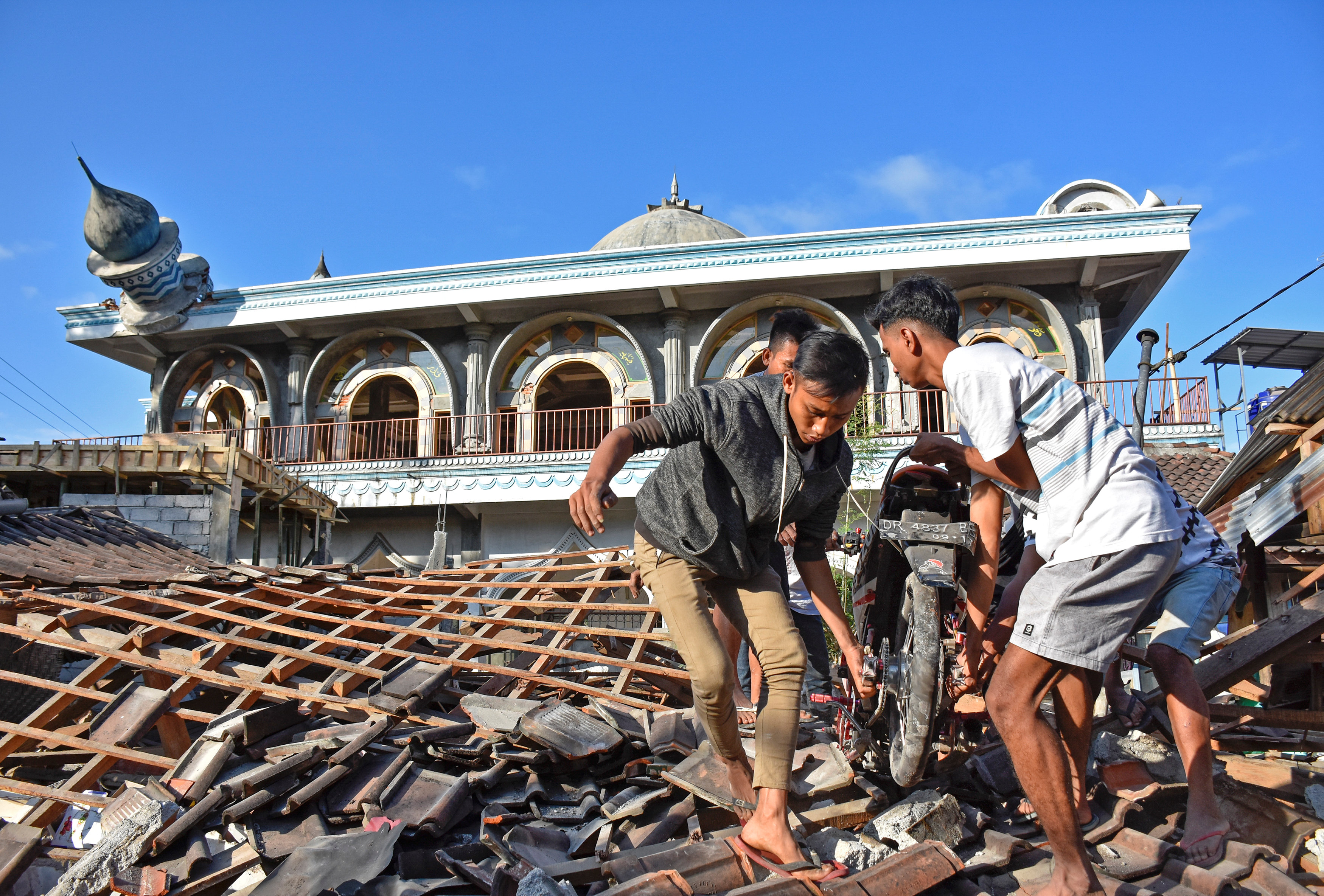
A house is left destroyed by an earthquake, triggered by a previous day quake, near the epicenter in Trona, California, U.S., July 6, 2019. REUTERS/David McNew
The powerful magnitude 7.1 earthquake rocked the Mojave Desert town of Ridgecrest south of Death Valley National Park as darkness fell on Friday, jolting the area with eight times more force than a 6.4 quake that struck the same area 34 hours earlier.
California Governor Gavin Newsom placed the state Office of Emergency Services (OES) on its highest alert and requested federal assistance.
He told a news conference in Ridgecrest on Saturday that he had just got off a phone call with U.S. President Donald Trump, seeking a presidential emergency declaration.
“I have full confidence that the president will be forthcoming, in immediate terms, with the formal declaration,” Newsom said, flanked by first responders.

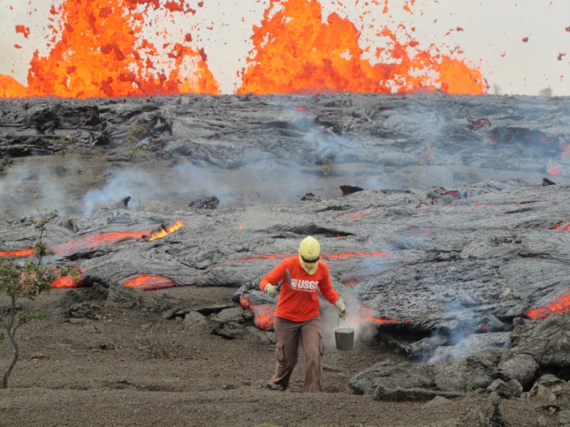
Cracks emerge on a road after an earthquake broke in Trona, California, U.S., in this photo from the USGS posted on July 6, 2019. USGS/Handout via REUTERS
There were several minor to moderate injuries, OES Director Mark Ghilarducci told reporters.
“No reports of any fatalities, so I think we’re very lucky there,” he said.
There were reports of building fires, mostly as a result of gas leaks or gas-line breaks, Ghilarducci said.
State officials said all roads damaged by the quakes had been repaired and reopened.
Violent shaking also caused water-main breaks and knocked out power and communications to parts of Ridgecrest, home to about 27,000 people some 125 miles (200 km) northeast of Los Angeles.
Officials warned there was sure to be a significant number of aftershocks, including possible powerful ones, and advised residents to ensure they had necessary supplies.
“I’ve said this ad nauseam: be prepared for the worst,” said Newsom, who on Saturday met victims in the hospital and visited a hardware store where the earthquake hurled products from shelves and left ceiling tiles scattered across the aisles.
Standing outside her damaged home in Ridgecrest, life-long resident Sierra Wood said it was heartbreaking and scary.
“This is the first time I’ve ever seen anything like this,” she said. “I mean – they say that it’s happened and you’ve heard about it. But once you’re in it, it’s completely different, it’s terrifying. It’s terrifying.”
Her husband, Keith Wood, said the aftershocks were grueling.
“It’s like when, when do we get a break from it?” he said. “When is enough enough? Mother Nature has had her way. Give us a break now, OK?”

Evacuees leave a fire station with their belongings after an earthquake near Trona, California, U.S. July 6, 2019. REUTERS/Gene Blevins
The sprawling U.S. Naval Air Weapons Station China Lake just northwest of Ridgecrest was evacuated of all non-essential personnel following the quake.
The facility, which at more than 1.1 million acres (445,000 hectares) is larger than the state of Rhode Island, reported no injuries. Authorities were assessing any damage to buildings or other infrastructure, according to a post on the base’s Facebook page.
MORE TO COME
Friday’s earthquake was widely felt across Southern California, including greater Los Angeles, where shaking in some areas lasted about 40 seconds. Low-level rumbling extended as far north as the San Francisco Bay area and beyond to Reno, Nevada, and as far east as Phoenix, Arizona.
Seismologists said the initial quake on Thursday, and scores of smaller ones that followed it, proved to be foreshocks to Friday’s larger temblor, which now ranks as Southern California’s most powerful since a 7.1 quake that struck near a U.S. Marine Corps base in the Mojave Desert in 1999.
The U.S. Geological Survey said Friday’s quake was immediately followed by at least 16 aftershocks of magnitude 4 or greater and warned of a 50 percent chance of another magnitude 6 quake in the coming days. Geologists put the chance of another magnitude 7 tremor at 10 percent over the next week.
There were hundreds of aftershocks of 2.5 magnitude or greater in the area surrounding the epicenter, according to USGS data.
Victor Abdullatif was helping clean up broken bottles and other debris inside his father’s liquor store, the Eastridge Market, which sustained damage to its ceiling, and found the periodic aftershocks unnerving.
“They’re still scary because you almost don’t know, ‘Is this going to be a full earthquake?’ You have to kind of have faith that it’s just an aftershock,” he told Reuters.
The last major destructive quake to hit Southern California was the 6.7 magnitude Northridge quake in 1994, which struck a densely populated area of Los Angeles. It killed 57 people and caused billions of dollars in property damage.
The comparatively limited damage from Friday’s quake, which packed greater force than the Northridge event, was a function of its location in a remote, less developed area.
Its ground motion, however, startled seismically jaded Southern Californians over a wide region.
Pools in Los Angeles sloshed wildly, and TV cameras at Dodger Stadium were shaking as they filmed the night Major League Baseball game between the Los Angeles Dodgers and San Diego Padres.
A television anchorwoman ducked out of sight during a local newscast as shouts of “get under a desk” were heard in the background.
(Reporting by Alan Devall; Additional reporting by Bill Tarrant, Steve Gorman, Alex Dobuzinskis, Joseph Ax and Keith Coffman; Writing by Steve Gorman; Editing by Toby Chopra, Will Dunham and David Gregorio)