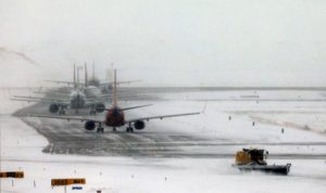
Two Winter Storms to Hit Millions

1 Timothy 5:8 “But if anyone does not provide for his relatives, and especially for members of his household, he has denied the faith and is worse than an unbeliever.

Important Takeaways:

  • One-two punch of storms to bring rounds of rain, snow and storms to millions
  • A blast of arctic cold in the West and into the Northern Plains was also expected to be the longest-duration cold outbreak of the winter season so far.
  • Snow will be heaviest across parts of Minnesota as well northern Wisconsin and northern Michigan. Additional snowfall of up to 6 inches will be possible, bringing storm totals of 1 to 2 feet in some areas. The snow, combined with wind gusts up to 30 mph, will lead to dangerous travel conditions.

Read the original article by clicking here.

Artic blast effects millions

Luke 21:7 “Teacher,” they asked, “when will all this happen? What sign will show us that these things are about to take place?” Luke 21:11 “There will be great earthquakes, and there will be famines and epidemics in many lands, and there will be terrifying things (that which strikes terror), and great miraculous signs in the heavens.”

Important Takeaways:

  • Millions of Americans under winter weather alerts for storms, arctic blast
  • More than 80 million people across the United States are on alert this week for heavy snow, brutally cold temperatures, gusty winds and icy conditions
  • Hundreds of people were stranded in a massive traffic jam across a 48-mile stretch of I-95 in Virginia, following a multi-vehicle accident

Read the original article by clicking here.

California braces for more lightning as wildfires kill 7

By Adrees Latif

AETNA SPRINGS, Calif. (Reuters) – California braced for more lightning storms, which have sparked over 600 wildfires in the past week, but firefighters got some relief as temperatures eased off record highs.

The worst of the blazes, including the second and third largest in California history, burned in the San Francisco Bay Area with roughly 240,000 people under evacuation orders or warnings across the state.

Much of Northern California, including the Sierra Nevada Mountains and coast, was under a “red flag” alert for dry lightning and high winds, but the National Weather Service dropped its warning for the Bay Area.

Close to 300 lightning strikes sparked 10 new fires overnight and more “sleeper fires” were likely burning undiscovered in areas shrouded by dense smoke, Governor Gavin Newsom said.

One huge blaze burned in ancient coastal redwood forests south of San Francisco that have never seen fire due to usually high relative humidity levels, Newsom said.

“We are in a different climate and we are dealing with different climate conditions that are precipitating fires the likes of which we have not seen in modern recorded history,” Newsom told a news briefing.

The wildfires, ignited by over 13,000 lightning strikes from dry thunderstorms across Northern and Central California since Aug. 15, have killed at least seven people and destroyed over 1,200 homes and other structures.

Smoke from wildfires that have burned over 1.2 million acres (485,620 hectares), an area more than three times larger than Los Angeles, has created unhealthy conditions for much of Northern California and drifted as far as Kansas.

The LNU Complex, the second largest wildfire in state history, began as a string of smaller fires in wine country southwest of Sacramento but has merged into a single blaze that has burned around 350,000 acres of Napa, Sonoma, Lake, Yolo and Solano counties.

It was 22% contained as of Monday while to the south the SCU Lightning Complex was nearly as large, at 347,000 acres, and only 10% contained.

“I’m nervous, I don’t want to leave my house, but lives are more important,” Penny Furusho told CBS television affiliate KPIX5 after she was told to evacuate from the south flank of the SCU fire.

Over 14,000 firefighters are on the wildfires, with 91 fire crews traveling from seven states and National Guard troops arriving from four states, Newsom said.

(Reporting by Adrees Latif in Aetna Springs, California; Editing by Tom Brown)

Two storms head for U.S. Gulf in rare hurricane season event

By Liz Hampton

(Reuters) – A pair of tropical cyclones forecast to become hurricanes early next week are headed for the U.S. Gulf Coast and will spin over the Gulf’s warm waters simultaneously, a rare weather event that could cause massive disruption as they make landfall.

The last time two cyclones entered the U.S. Gulf of Mexico was in 1959, according to meteorologists interviewed by Reuters, and there have only been a handful of other occasions when two storms entered the Gulf simultaneously. In 1933, a Category 3 hurricane and moderate tropical storm hit the U.S. Gulf of Mexico, but there haven’t been records of two hurricanes in the Gulf of Mexico at the same time.

Tropical Storm Laura and a separate tropical depression brewing near Honduras could make landfall as hurricanes next week in an area spanning Texas to the Florida Panhandle, according to the National Hurricane Center.

Meteorologists say there is still a lot of uncertainty around the systems and how they develop and move in coming days, particularly as they cross land.

Both storms currently look on track to remain separate, however, any interaction between the two could change their intensity or trajectory, said Dan Kottlowski of AccuWeather. It is unlikely they would combine, he added.

“More than likely one will become stronger, and inflict more vertical wind shear causing the other to weaken,” Kottlowski. “But if they stay of equal strengthen, then they will probably prevent each other from getting really strong.”

In some cases when storms interact, they can orbit each other and the speed of one cyclone could accelerate the other, part of something known as the “Fujiwhara effect,” said David Streit of Commodity Weather Group.

Tropical Storm Laura, which is currently east of the Antilles, was upgraded from a depression on Friday and currently has sustained winds of 45 miles per hour, according to the NHC. Laura is forecast to make landfall as a hurricane on Wednesday in an area spanning Louisiana to the Florida panhandle.

Tropical Depression 14, which would be named Marco if it strengthens, is on track to make landfall on Tuesday near the Texas and Louisiana border. It would arrive around the three-year anniversary of Hurricane Harvey, which dumped a record 50 inches of rain on parts of Houston in August 2017 and caused billions of dollars in damage.

“Tropical Depression 14 doesn’t look robust right now, but it looks to be in an environment conducive to strengthening,” said Phil Klotzbach, a research scientist at Colorado State University.

AccuWeather’s Kottlowski said that Tropical Depression 14 is likely to become the stronger storm as it is slated to pass over a relatively flat area of the Yucatan Peninsula before entering the warm waters of the Gulf of Mexico, where it can gain strength.

(Reporting by Liz Hampton; Editing by Simon Webb and Aurora Ellis)

U.S. winter storms cause 10 deaths, flight cancellations, power outages

(Reuters) – At least 10 people died, more than 1,000 flights were canceled and hundreds of thousands were without power in five states on Saturday as a massive winter storm system dumped snow, freezing rain and hail from Texas to Michigan.

Hurricane-force wind gusts, golf-ball-sized hail and 2 to 5 inches (5-13 cm)of snow fell on Friday night and early Saturday as storms pushed from Texas through the Southeast and Great Lakes into Maine, the National Weather Service (NWS) said.

More snow with accumulations between 6 to 12 inches was expected through Sunday in parts of Illinois, Michigan, northern New York and New England.

“The real danger comes from the wind and ice accumulation,” said NWS forecaster Bob Oravec in College Park Maryland.

More than half an inch of ice was predicted to cake highways and roads across the South and Northeast from Saturday night to Sunday morning, he said.

“The ice and wind will make driving treacherous, and trees can snap and knock out power and do other damage,” he said.

Two people were killed when the storm destroyed a trailer home in northwestern Louisiana late Friday, according to the Bossier Parish Sheriff’s Office. Local media reported that a third person died after a tree fell on a home in that state.

A fourth person was killed Friday in the storms when a car slide off the road and into a creek in Dallas, NBC news reported.

A firefighter and a police officer in Lubbock, Texas, were killed Saturday after a car slid on ice-slicked U.S. Interstate Highway 27 as they were investigating a traffic accident, Lubbock Fire officials said.

Three more storm-related deaths occurred in Pickens County in western Alabama, CNN reported, but details were not immediately available.

A 10th person died in southeastern Oklahoma on Saturday morning after the 58-year-old man was swept away while his pickup truck was stalled in deep water on a flooded road, the Houston Chronicle reported.

More than 257,000 homes and businesses were without power across Alabama, Mississippi, Kentucky, Tennessee and Arkansas according the tracking site PowerOutage.us. Heavy outages in Texas, Michigan and Illinois were largely repaired by late Saturday afternoon.

The bulk of the nation’s flight delays and cancellations were at Chicago’s O’Hare International Airport, with more than 1,000 flights canceled and hundreds more delayed, according to flightaware.com.

Tornadoes damaged or destroyed some buildings in Arkansas and Missouri, forecasters said.

NWS said more than 18 million people in Louisiana, Arkansas, Texas and Oklahoma remained at risk of tornadoes and flooding rains. Oravec said that hurricane-force wind gusts of about 75 mph (120 kph) hit the southeast.

As the system pushes eastward, rain should end overnight in many southern states, but the Northeast and New England can expect severe weather to last for another day, he said.

(Reporting by Rich McKay in Atlanta; Editing by Marguerita Choy and Cynthia Osterman)

Two powerful storms thrash U.S. as millions head to Thanksgiving celebrations

Two powerful storms thrash U.S. as millions head to Thanksgiving celebrations
(Reuters) – Two major winter storms thrashing the western two-thirds of the United States on Wednesday appear set to disrupt the travel plans of millions of Americans headed to Thanksgiving Day destinations on jam-packed highways and airplanes.

The first storm front was moving across the upper Midwest, where it was forecast to clobber parts of Iowa, Wisconsin and Minnesota with almost a foot of snow (30 cm) and wind gusts of up to 50 mph (80 kph), making travel difficult if not impossible, the National Weather Service (NWS) said.

It also warned of possible winds of up to 60 mph (95 kph) and rainstorms across a wide swath of the central U.S. from western Texas up through Missouri and into Ohio on Wednesday, as millions will hit the roads and board airplanes for the holiday.

The treacherous weather jeopardized travel plans for some of the 55 million Americans expected to fly or drive at least 50 miles (80 km) from their homes for Thursday’s Thanksgiving holiday, according to the American Automobile Association.

“It’s a real bummer,” said Ally Lytle, a 20-year-old student at the University of Wyoming in Laramie, who will be unable to make 400-mile (645-km) road trip home to Jackson Hole after the storm swept through the area on Tuesday.

The storm had already closed highways across the region and canceled and delayed hundreds of flights in and out of Denver on Tuesday.

Wind gusts of more than 40 mph (65 kph) on the East Coast on Thursday may also ground the giant balloons featured during the Macy’s Thanksgiving Day Parade in New York City, the weather service said in an advisory.

“Look, I know this weather means people won’t get to see their families, might be stranded in airports, etc, and all of that is awful,” said Susan Arendt on Twitter. “But I’ll be really sad if the wind means no balloons in the Macy’s parade.”

The second storm was rapidly intensifying as it pushed toward Oregon and northern California, where damaging winds, coastal flooding and heavy mountain snows of up to 4 feet (120 cm) were forecast, the NWS said.

The front was also expected to dump heavy rain, threatening flash floods across southern California, from San Diego to Los Angeles, the weather service said.

(Reporting by Brendan O’Brien in Chicago; Editing by Clarence Fernandez)

Rising U.S. losses from powerful hurricanes flag need for better protection

A police car is submerged in New Orleans East August 31, 2005 after Hurricane Katrina hit the area. Authorities struggled on Wednesday to evacuate thousands of people from hurricane-battered New Orleans as food and water grew scarce and looters raided stores, [while U.S. President George W. Bush said it would take years to recover from the devastation.]

Rising U.S. losses from powerful hurricanes flag need for better protection
By Anna Scholz-Carlson

LONDON (Thomson Reuters Foundation) – Only a few U.S. states are taking significant steps to reduce hurricane risks, as a study this week showed the most damaging storms are now three times as frequent as a century ago and have become the costliest type of disaster, scientists said.

Using a new method, a team at the University of Copenhagen’s Niels Bohr Institute found the frequency of the worst hurricanes had increased 330% over the last century in the United States.

But many government authorities in the country remain unprepared to deal with the surging risk, said Natalie Peyronnin Snider, senior director of coastal resilience for the Environmental Defense Fund (EDF), a U.S.-based advocacy group.

Getting ready would require policy and ground-level changes, including efforts to boost coastal protection, she said.

In a study published in the journal Proceedings of the National Academy of Sciences of the United States of America (PNAS), University of Copenhagen scientists looked at parts of the United States hit by hurricanes in the last century, analysing changes in wealth and population densities to compare losses over time.

Previous research suggested the growing costs of damage from storms were largely due to costlier infrastructure and homes in their path, rather than a rise in the strength or frequency of hurricanes themselves, said Aslak Grinsted, a study lead author.

But the new work showed the growing number of powerful hurricanes was the key factor in increasing losses, he said.

Having clearer information should help communities plan ahead to curb losses, he told the Thomson Reuters Foundation.

Louisiana is one of the few states that has a comprehensive plan to deal with a growing hurricane threat, said EDF’s Snider.

In 2012, it launched a $50-billion Coastal Master Plan to elevate homes with severe flooding risk, create more wetlands, restore marshes and create rock breakwaters to better protect communities from surging storms.

The effort aims to help the southern state better weather hurricanes over the next 50 years, according to the Louisiana Coastal Protection and Restoration Authority website.

The plan was in part a response to severe losses from Hurricane Katrina in 2005, it noted.

Snider said using natural systems to curb hurricane risk – such as wetlands that can absorb excess water and prevent flooding or oyster-covered reefs to absorb wave energy – are cost-effective ways to curb damage from powerful hurricanes.

But Louisiana is not the only state looking to lower its hurricane risks.

In New York, a community-led project aims to restore 1 billion live oysters to New York Harbor by 2035, in part to tackle storm threats, according to its website.

Still, federal and state governments need to do more to protect their people, assets and ecosystems, Snider said.

“It’s really important that we start to be proactive and aggressive … in building resilience in our systems, which not only pays off financially but also for the health of communities,” she said.

Each dollar spent to cut disaster risk can save six dollars otherwise spent recovering after a disaster, she added.

(Reporting by Anna Scholz-Carlson; editing by Laurie Goering and Megan Rowling. Please credit the Thomson Reuters Foundation, the charitable arm of Thomson Reuters, that covers humanitarian news, climate change, resilience, women’s rights, trafficking and property rights. Visit http://news.trust.org/climate)

Rains ease, Oklahoma, Arkansas and Louisiana still face flood of ‘historic magnitude’

A mattress and dresser drawer are among the debris scattered on a lawn near a damaged house after several tornadoes reportedly touched down, in Linwood, Kansas, U.S., May 29, 2019. REUTERS/Nate Chute

By Alex Dobuzinskis and Rich McKay

(Reuters) – Thousands of Arkansas, Oklahoma and Louisiana residents braced for more flooding on Thursday as swollen rivers continued to rise, although the threat of rain was expected to ease by the afternoon, officials said.

Many in the U.S. Southern states have already evacuated homes, as of further flooding drove fears that decades-old levees girding the Arkansas River may not hold.

There were no reports of major levee breaks early on Thursday, said Dylan Cooper, a meteorologist with the National Weather Service’s office in Little Rock, Arkansas.

“The rivers and tributaries are still rising from all that water flowing downstream from up north,” said Cooper.

“We call it the bathtub effect. There’s only so much water that the levees and reservoirs can hold before that water just spills over,” he said.

The only good news is that it looks like the area is going to have a dry few days into the weekend, said Bob Oravec, a meteorologist with the NWS Weather Prediction Center in College Park, Maryland.

“They can use any dry weather they can get,” said Oravec.

More than a week of violent weather, including downpours and deadly tornadoes, has lashed the central United States, bringing record-breaking floods in parts of the states, turning highways into lakes and submerging all but the roofs of some homes.

Arkansas Governor Asa Hutchinson told a news conference on Wednesday, that the state is experiencing a “flood of historic magnitude.”

Flooding has already closed 12 state highways, he said, and 400 households have agreed to voluntary evacuations.

Hutchinson sent a letter to U.S. President Donald Trump on Wednesday asking for a federal emergency declaration for Arkansas.

The levee system along the Arkansas River “has not seen this type of record flooding” before, Hutchinson said in his six-page letter.

Hutchinson said Trump had promised assistance in an earlier conversation, several media outlets reported.

Rivers were expected to crest by early June to the highest levels on record all the way down to Little Rock, Arkansas, forecasters said.

“We’ve had river highs of 44.9 feet in places,” said Cooper of the Arkansas River. “We’re blowing through records.”

In Tulsa, Oklahoma’s second largest city, Mayor G.T. Bynum warned that the city’s levees were being tested “in a way that they have never been before.”

He said the 20-mile (32 km) levee system, which protects some 10,000 people, was working as designed so far and being patrolled around the clock by the Oklahoma National Guard.

At least six people have died in the latest round of flooding and storms in Oklahoma, according to the state’s Department of Health.

More than 300 tornadoes have touched down in the Midwest in the past two weeks. Tornadoes pulverized buildings in western Ohio on Monday, killing one person and injuring scores.

In Louisiana, the Mississippi River was also at record flood levels due to record-breaking rainfalls this spring, forecasters said.

Trump authorized emergency aid from the Federal Emergency Management Agency for the state late on Wednesday.

In Baton Rouge, Louisiana, the Mississippi rose above flood stage in early January and has remained there since, forecasters said.

(Reporting by Alex Dobuzinskis in Los Angeles, Rich McKay in Atlanta, and Jonathan Allen in New York; Editing by Raissa Kasolowsky)

One dead, dozens hurt as tornadoes flatten buildings in Ohio

A family leaves their apartment complex in the morning after a tornado touched down overnight in Trotwood near Dayton, Ohio, U.S. May 28, 2019. REUTERS/Aaron Josefczyk

(Reuters) – Tornadoes pulverized western Ohio early on Tuesday, killing one person, injuring scores of others and requiring emergency officials to send out snowplows to clear debris from a major highway, officials and media reports said.

At least one tornado hit Dayton and at least two touched down near the city, including one near Wright-Patterson Air Force Base, just east of the city, media reports said.

A child's toy car sits among debris from a tornado that touched down overnight in Trotwood near Dayton, Ohio, U.S. May 28, 2019. REUTERS/Aaron Josefczyk

A child’s toy car sits among debris from a tornado that touched down overnight in Trotwood near Dayton, Ohio, U.S. May 28, 2019. REUTERS/Aaron Josefczyk

An 81-year-old man was killed in Celina, a small city 65 miles (105 km) north of Dayton, after a tornado sent a vehicle crashing into his home, Celina Mayor Jeffrey Hazel said at a news conference on Tuesday. Another seven people were injured in the storm, three of them seriously, he said.

At least 35 people in and around Dayton went to hospitals with injuries, most of them minor, according to Elizabeth Long, a spokeswoman for the Kettering Health Network.

“We’ve had injuries ranging from lacerations to bumps and bruises from folks being thrown around in their houses due to the storms,” she said.

The latest storm follows tornadoes and floods killed at least six people in Oklahoma during the previous week, including two people in El Reno on Saturday.

More than 60,000 homes and businesses in Ohio were left without power on Monday morning, according to the PowerOutage.US tracking service, and officials advised people to boil water after water plants and pumps went out of service.

Some media outlets reported that rescue workers were going door-to-door in parts of Dayton.

Twitter users posted images of debris flying in the air and damaged mobile homes and cars.

Media images online showed snowplows from the Ohio Department of Transportation clearing debris from U.S. Interstate 75 just north of the city.

The National Weather Service said multiple tornadoes were reported in the Dayton area between 11 p.m. Monday and 1 a.m. Tuesday.

A car is covered with debris that was ripped from an apartments building after a tornado touched down overnight in Trotwood near Dayton, Ohio, U.S. May 28, 2019. REUTERS/Aaron Josefczyk

A car is covered with debris that was ripped from an apartments building after a tornado touched down overnight in Trotwood near Dayton, Ohio, U.S. May 28, 2019. REUTERS/Aaron Josefczyk

“The storm system is weakening as it pushes into West Virginia and Virginia, but along with the winds, it has dropped about two or three inches 3 inches (5-8 cm)of rain in just two hours,” said Zack Taylor, a meteorologist with the NWS Weather Prediction Center in College Park, Maryland.

Seven people were reported injured in the storm in Pendleton, Indiana, on Monday, about 100 miles (160 km) west of Dayton, according to media reports. More damage was reported in Celina, Ohio, about 78 miles (125 km) north of Dayton.

Flooded areas of Arkansas and Oklahoma were bracing for more rain that will feed the already swollen Arkansas River, forecasters said on Monday. Arkansas, Oklahoma and Missouri have all activated National Guard units to respond to the storms.

Early on Tuesday, U.S. President Donald Trump expressed his support for Oklahoma Governor Kevin Stitt, a Republican. Trump promised support from the Federal Emergency Management Agency.

Millions of Americans were under flood warnings on the Memorial Day holiday. Deluges hit Kansas, Nebraska, Iowa and Illinois.

In Tulsa, officials were monitoring the Arkansas River after the U.S. Army Corps of Engineers raised the flow at the upriver Keystone Dam by 65% since last week to 275,000 cubic feet per second. The heavier flow is testing two aging levees in Tulsa, the city said.

In Missouri, tornadoes and severe storms killed three people and destroyed or damaged hundreds of homes last week.

(Reporting by Rich McKay in Atlanta, Jonathan Allen and Peter Szekely in New York; Editing by Scott Malone and Bill Trott)

Storms and sweltering heat seen hitting U.S. South on Memorial Day

FILE PHOTO: A path of destruction through the Skyview Mobile Park Estates is seen in an aerial photo after a tornado touched down overnight in El Reno, Oklahoma, U.S. May 26, 2019. REUTERS/Richard Rowe

By Rich McKay

(Reuters) – Sweltering heat, storms and possible twisters were expected to hit the U.S. southern Plains and southeastern states on Memorial Day after a spate of deadly tornadoes and flooding in the region.

Temperatures around 100 degrees Fahrenheit (38 Celsius) were forecast in cities from Jacksonville, Florida, up the southeast into Macon and Savannah Georgia, and on to Charleston, South Carolina, the National Weather Service said.

“This is super hot for this time of year,” said John Deese, a NWS forecaster in Peachtree, Ga., near Atlanta.

“This is a heat wave across the south, and it’s going to be here for a while,” said Deese, predicting high temperatures through the week staying in the mid to high 90s in the region.

The risk of strong tornadoes are moderate but remain possible through the week for the southeastern Plains states, already hit by lethal twisters last week, forecasters said.

The latest severe tornado killed two people in El Reno, Oklahoma late Saturday, injured at least 29 people, and left hundreds homeless, officials said.

Four more people were killed in the same storm in Oklahoma, CNN reported Sunday.

Rescue workers on Sunday searched for survivors in the rubble left by the tornado that devastated parts of the small community near Oklahoma City, officials said.

At least seven other people were killed by storms last week.

U.S. southern Plains including Nebraska, Oklahoma, Kansas and parts of Ohio will remain under flood watches and warnings through the week, as rains, wind, hail and possible twisters are in the forecast, said David Roth of the NWS Weather Prediction Center in College Park Maryland.

As for the southeast from Florida to Virginia – “It’ll stay hot,” he said. “This weather pattern is just parked, persistent.”

(Reporting by Rich McKay in Atlanta; Editing by Andrew Heavens)