China facing global isolation as virus toll rises

By David Stanway and Winni Zhou

SHANGHAI (Reuters) – China faced mounting isolation in the face of increasing international travel curbs and flight suspensions on Saturday, as the death toll from a spreading coronavirus outbreak rose to 259.

The epidemic has led to mass evacuations of foreign citizens as world airlines halt flights, and risks exacerbating a slowdown in growth in the world’s second-largest economy.

China’s National Health Commission said there were 2,102 new confirmed infections in China as of Friday, bringing the total to 11,791. Around two dozen other countries have reported more than 130 cases.

All of the reported deaths from the virus have been in China.

The Russian military was to start evacuating Russian citizens from China on Monday and Tuesday, Interfax and TASS news agencies reported. Kremlin spokesman Dmitry Peskov was quoted as saying the evacuations would be from regions that had been most affected by the outbreak.

Russia, which has already restricted direct flights with its biggest trading partner, also said it was suspending visa-free travel for Chinese visitors and halting work visas.

Most international cases have been in people who had recently traveled to or were visiting from Hubei province, the epicenter of the outbreak.

Hubei has been under a virtual quarantine for the last week, with roads sealed off and public transport shut down. Elsewhere, Chinese authorities placed growing restrictions on travel and business.

In Beijing, counters were set up at the entrances of housing estates, where volunteers wearing red arm bands and masks noted details of residents coming back from their hometowns after the Lunar New Year holiday.

“As long as I am properly protected and don’t go to crowded places, I don’t feel scared at all about my hometown or Beijing,” said a 58-year-old migrant worker surnamed Sun.

Others were more worried.

“There will be a huge number of people returning to the city. I think it will put Beijing at risk of more infections,” said Zhang Chunlei, 45, another returning migrant worker.

In Hubei, the provincial government extended the holiday break to Feb. 13 in a bid to contain the outbreak, the Hubei Daily reported.

The World Health Organization, which this week declared the outbreak a public health emergency of international concern, has said global trade and travel restrictions are not needed.

But Singapore and the United States announced measures on Friday to ban foreign nationals who have recently been in China from entering their territories. Australia followed suit on Saturday.

“We’re in fact operating with an abundance of caution in these circumstances so Australians can go about their daily lives with confidence,” Prime Minister Scott Morrison told reporters in Sydney.

The Chinese data would suggest the flu-like virus is less deadly than the 2002-03 outbreak of Severe Acute Respiratory Syndrome (SARS), which killed nearly 800 people of the some 8,000 it infected, although such numbers can evolve rapidly.

EVACUATIONS

The list of international airlines suspending all or some flights to China is growing.

The latest were Qantas Airways Ltd and Air New Zealand, who said travel bans forced them to suspend their direct flights to China from Feb. 9. All three major U.S. airlines said on Friday they would cancel flights to mainland China.

The commander of U.S. forces in the Pacific banned travel to China for all service members and civilian personnel under his authority and ordered those now in China to leave immediately, officials said.

U.S. health officials on Saturday confirmed an eighth case of the virus, a person in Massachusetts who recently returned from Hubei province.

Many nations have sent charter flights to repatriate citizens from China and then place them in isolation for around two weeks, believed to be the incubation period of the virus.

German Health Minister Jens Spahn called for calm and warned against hysteria as more than 100 Germans and family members landed in Frankfurt, none showing any symptoms of the virus. As of Saturday evening Germany had eight confirmed cases.

Britain, which has had two confirmed cases, said it was withdrawing some staff from its embassy and consulates in China.

Many of the private clinics catering to foreigners in China have started to turn away people with fevers.

“I don’t want to go to the local hospital with a sore throat only to catch something else,” said Czech national Veronika Krubner in Tianjin.

DISRUPTIONS

Infections have jumped in two cities flanking Wuhan, where the new virus is believed to have originated, raising concerns that new hot spots are emerging despite strict transport restrictions.

In Huanggang, authorities asked households to designate one individual who can leave the home, a local newspaper said. The mayor of the city of about 7.5 million people said there could be a significant rise in cases this weekend.

The northern city of Tianjin, home to some 15 million, suspended all schools and businesses until further notice.

Efforts to contain the virus risk slowing economic growth in China. The virus impact prompted Goldman Sachs to cut its estimate for first-quarter growth to 4% from 5.6%.

China’s central bank said the impact was temporary and economic fundamentals remained sound, but that it would increase credit support, lowering lending costs for affected companies.

Apple Inc said on Saturday it would close all of its official stores and corporate offices in China until Feb. 9, the latest of dozens of major companies, including IKEA and Walmart Inc, to restrict travel and operations due to the outbreak.

For a graphic comparing this with previous coronavirus outbreaks, see https://graphics.reuters.com/CHINA-HEALTH-VIRUS-COMPARISON/0100B5BY3CY/index.html

(Reporting by Winni Zhou, Brenda Goh and David Stanway in Shanghai, Judy Hua, Se Young Lee, Yilei Sun and Gabriel Crossley in Beijing, Scott Murdoch in Hong Kong, Joori Roh in Seoul, Nick Mulveney in Melbourne, Chris Helgren in Toronto, and Vera Eckert in Frankfurt; Writing by Nick Macfie and Rosalba O’Brien; Editing by Andrew Heavens, Frances Kerry and Bill Berkrot)

Historic blizzard wanes as it barrels east after pounding parts of U.S.

A general view of the blizzard in Greeley, Colorado, U.S. March 13, 2019 in this picture obtained from social media. Mandatory credit TWITTER @PHOTOWILLG/via REUTERS

By Keith Coffman

DENVER (Reuters) – A blizzard of “historic proportions” that hit the U.S. Rocky Mountain and Plains states this week was moving eastward on Thursday as it weakened, hurling hurricane-force winds and heavy rain on its way, weather officials said.

“While the storm has reached its lowest pressure and will gradually weaken over the next few days, strong winds will continue on the west side of the storm across portions of the Central and Northern Plains,” Bob Oravec, a meteorologist with the National Weather Service (NWS), said on Thursday in a weather advisory.

A day earlier, the NWS had described the cyclone as being of ‘historic proportions’ in a post on Twitter. Hurricane-force winds involve frequent gusts or sustained winds of more than 74 miles per hour.

The blizzard, bringing severe snowfall, poor visibility and powerful winds, caused hundreds of flight cancellations and thousands of power outages in Colorado and Texas. It was expected to unleash similar conditions over areas in Colorado, Wyoming, Nebraska, South Dakota and North Dakota before moving into northwest Minnesota, Oravec said.

While some flights resumed at Denver International Airport, the airport was not expected to be fully operational until midday on Thursday, as airlines were still dispatching more planes to Denver to replace those diverted or canceled earlier, airport spokeswoman Emily Williams told Reuters.

Flight cancellations were down to more than 600 on Thursday morning, from more than 1,300 in the region a day earlier, according to FlightAware.com.

Power outages in Colorado affected about 80,000 homes and businesses, down by 8,000. About 60,000 in Texas also experienced outages on Thursday, dropping by 17,000.

Stranded motorists across the region had been reached and given assistance before midnight, a spokesman for the Colorado State Patrol spokesman said early Thursday. Around 1,100 motorists were reported as stranded on Interstate 25 near Colorado Springs a day earlier.

A state of emergency was still in effect in Colorado as cities and towns dug out from the storm, during which strong, 70-mile-per-hour wind gusts pushed tractor trailers sidewise and left up to two feet of snow in some areas.

The storm was blamed for the death of a Colorado state trooper, who was hit by a car that slid on ice on the highway as he was attending to a car wreck.

Schools and government offices remained closed Thursday across the region.

The blizzard, previously dubbed a “bomb cyclone” by U.S. meteorologists for its quick, late-season punch, was still expected to prompt warnings of blizzards and snow before noon in north-central Kansas and Nebraska, Brian Hurley, a meteorologist with the National Weather Service, said early on Thursday.

Remnants of the snowfall and rain would clear from Denver and the mountain and plains areas by midday, he said.

(Reporting by Keith Coffman in Denver; writing and additional reporting by Rich McKay in Atlanta and Gina Cherelus in New York; Editing by Bernadette Baum)

Colorado trooper killed as ‘Bomb Cyclone’ unleashes snow, high winds

A policeman talks to a driver as snow clogs the roads in Lone Tree, Colorado, U.S. in this March 13, 2019 handout photo. City of Lone Tree, Colo./Handout via REUTERS

By Keith Coffman

DENVER (Reuters) – A late-winter blizzard slammed U.S. Rocky Mountain and Plains states on Wednesday, unleashing a “bomb cyclone” of high winds and drifting snow that stranded motorists, canceled more than 1,300 airline flights and was blamed for the death of a Colorado state trooper.

Colorado Governor Jared Polis declared a state of emergency due to the storm and said he had activated the state National Guard to assist in search and rescue operations.

Corporal Daniel Groves, 52, of the Colorado State Patrol is pictured in this undated handout photo obtained by Reuters March 13, 2019. Colorado State Police/Handout via REUTERS

Corporal Daniel Groves, 52, of the Colorado State Patrol is pictured in this undated handout photo obtained by Reuters March 13, 2019. Colorado State Police/Handout via REUTERS

The National Weather Service issued blizzard warnings for parts of Colorado, Wyoming, Nebraska and the Dakotas as schools and businesses were closed and local authorities urged residents to hunker down.

Meteorologists referred to the storm as a “bomb cyclone,” a winter hurricane that forms when the barometric pressure drops 24 millibars in 24 hours.

“So far, we have received 110 traffic crash reports and #Denver remains on #AccidentAlert,” the Denver Police Department said on Twitter.

“If you absolutely have to head out, please be cautious- it’s still #snowgoing out there. Turn your lights on, set the wipers on high; don’t forget the extra stopping distance. #BombCyclone”

The Colorado State Patrol said one of its troopers, Corporal Daniel Groves, was struck by a car that veered out of control on Interstate 76 and he died of his injuries a short time later at Platte Valley Medical Center in Brighton.

At the time, Groves, 52, was on the scene of another accident in which a vehicle had slid off the roadway, the state patrol said. It added that “high speed in poor driving conditions” was being investigated in connection with the crash that caused his death.

A general view of the blizzard in Greeley, Colorado, U.S. March 13, 2019 in this picture obtained from social media. Mandatory credit TWITTER @PHOTOWILLG/via REUTERS

A general view of the blizzard in Greeley, Colorado, U.S. March 13, 2019 in this picture obtained from social media. Mandatory credit TWITTER @PHOTOWILLG/via REUTERS

FLIGHTS DELAYED, CANCELED

All six runways at Denver International Airport were shuttered, along with the main road into the airport due to drifting, blowing snow. An airport spokesman said 1,339 flights had been canceled as of mid-afternoon. Colorado Springs Municipal Airport canceled all incoming flights.

All school districts in the seven-county Denver metropolitan were closed, along with most city and state government offices and many businesses.

Officials in El Paso County, Colorado, said some 1,100 motorists were stranded on Interstate 25 near Colorado Springs.

Utility company Xcel Energy said about 130,000 commercial and residential customers in Colorado were without power due to high winds and wet heavy snow.

“Limited visibility has affected our ability to respond,” Xcel Energy spokesman Mark Stutz said, adding it was unclear when power would be restored.

The police department in Northglenn, Colorado, tweeted a picture of a large tree that fell on a home, breaking through the roof. It was not immediately clear if anyone was hurt.

Interstate 70 was closed east of Denver to the Kansas state line and sections of Interstate 25 were also shut down, according to Colorado Department of Transportation.

“They typically do get strong systems this time of the year in that part of the country, but this one is maybe a notch stronger than what you typically see,” said meteorologist Marc Chenard of the weather service’s Weather Prediction Center in College Park, Maryland.

Forecasters said they expect winds of up to 70 miles per hour (110 kph) to sweep across a wide area of states to the south, including New Mexico and parts of Texas, Oklahoma and Kansas.

“Pretty much through much of the Plains there’s going to be a threat for potential power outage issues,” Chenard said.

More than 100,000 electric power customers in the Dallas-Fort Worth area were left in the dark early on Wednesday after a line of rain squalls associated with the system moved through the area.

The storm was also expected to bring heavy rain to areas of eastern Nebraska, Iowa, Wisconsin and Minnesota that already have a good deal of snow on the ground, raising the threat of river flooding, the weather service said.

The storm system is expected to weaken by Thursday as it moves over the Tennessee River Valley, bringing mostly rain from Michigan southward to the Gulf Coast and some remaining snow only in the far northern parts of the country, the weather service said.

(This story corrects name of Colorado governor in second paragraph)

(Reporting by Keith Coffman in Denver; additional reporting Peter Szekely in New York, Brendan O’Brien in Milwaukee and Dan Whitcomb in Los Angeles; Writing by Dan Whitcomb in Los Angeles; Editing by Bill Tarrant and Sandra Maler)

Late winter snow hammers U.S. northeast, icy conditions ahead

A worker cuts away a tree that fell across Riverside Drive during a snow storm in upper Manhattan in New York City, New York, March 4, 2019. REUTERS/Mike Segar

NEW YORK (Reuters) – New York faced its biggest snowstorm of the winter on Monday as snow spread across the northeastern United States, infuriating commuters who juggled canceled planes and trains and faced icy travels ahead as temperatures plunge.

A band of winter weather stretching from Maryland to Maine dumped 15 inches (38 cm) of snow overnight on downtown Boston and 5 inches (13 cm) on New York’s Central Park, said meteorologist Marc Chenard of the National Weather Service.

A woman makes her way through the snow on cross country skis during a winter storm in Pallisades, New York March 4, 2019. REUTERS/Mike Segar

A woman makes her way through the snow on cross country skis during a winter storm in Pallisades, New York March 4, 2019. REUTERS/Mike Segar

That was enough for New York Mayor Bill de Blasio to take the rare step of shutting the nation’s largest public school system and for New Jersey Transit, the largest statewide public transportation system in the United States, to cancel about a dozen commuter trains.

“This is horrible!” said Steve Wesley, 56, as he shoveled snow from his driveway in Maplewood, New Jersey, a New York City suburb.

Wesley’s two-mile local commute by car was delayed nearly two hours by the four to six inches of snow. 

“This is not what I want to be doing,” said Wesley, a sales representative for a power equipment distributor. “I’m usually the first one into the office. And if I get there and the parking lot is not plowed, I’ll be shoveling that too.”

Nearly 1,000 U.S. flights were canceled, most at Boston Logan International and New York area airports, according to FlightAware.com.

Government offices and libraries in Boston were closed. In New Jersey, where Governor Phil Murphy declared a state of emergency ahead of the storm, state workers had a two-hour delay.

Commuting challenges may mount over the remainder of the work week as snows melt and then temperatures drop, icing over roadways.

“Each day is a little bit cooler,” said Chenard, noting the week’s highest temperatures for the Northeast will be in the low 30s. “You’ll get some melting during the day, especially when the sun is hitting the snow, and then at night, it’s going to be cold enough to refreeze. Any road surfaces that aren’t treated certainly could get icy at night into the morning.”

(Reporting by Barbara Goldberg; Editing by Scott Malone and Steve Orlofsky)

Icy blast begins to ease in U.S. Midwest, Northeast

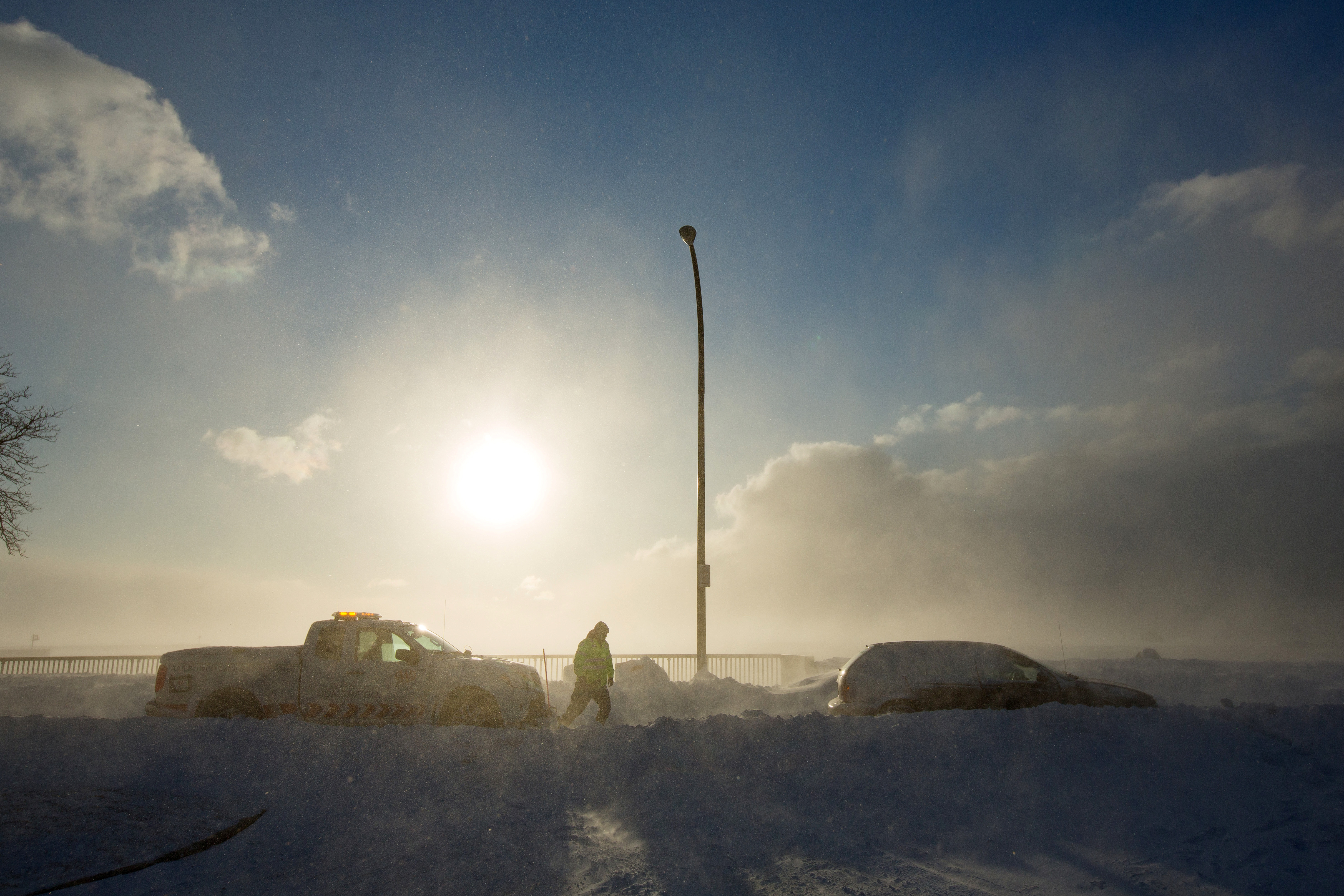
A worker from AAA aids vehicle trapped in snow during the polar vortex in Buffalo, New York, U.S., January 31, 2019. REUTERS/Lindsay DeDario

By Michael Hirtzer and Gina Cherelus

CHICAGO/NEW YORK (Reuters) – Frigid weather that paralyzed a large swath of the United States this week and caused at least 21 deaths began easing on Friday as an Arctic air mass pulled away, setting the stage for a warmer weekend in the Midwest and the Northeast.

Temperatures from southern New England to the Upper Midwest should reach the mid-40s to low 50s Fahrenheit through the weekend and Monday, forecasters said, after a record-breaking cold snap that stopped mail deliveries in some parts of the Midwest and shuttered schools and businesses.

In Chicago, which experienced temperatures as low as minus 22F (minus 30 Celsius) earlier this week, temperatures of 19F (-7C) on Friday morning felt positively balmy as a measure of normalcy returned to the nation’s third-largest city.

“It feels like summer,” said Dolores Marek, 57, as she got off her commuter train in Chicago wearing a long parka coat as set out on the 1.5 mile-(2.4 km) walk to the local college where she works. “This is much better than it was.”

Meteorologists linked the spell of brutal cold to the so-called polar vortex, a cap of icy air that usually swirls over the North Pole. Changing air currents caused it to slip down through Canada and into the U.S. Midwest this week.

Bryan Jackson, a National Weather Service meteorologist, said the core of the vortex was pulling north into eastern Canada, though residual icy air was still pushing over to the U.S. Northeast.

Temperatures on Friday morning ranged from below zero Fahrenheit to the teens in parts of New York, Pennsylvania, Massachusetts and New Jersey. The Washington D.C. area, which had 20F (minus 7C) temperatures, was under a winter weather advisory until the afternoon as around one inch (2.5 cm) of snowfall accumulated during the morning.

“That cold air that was over the Great Lakes, over the Midwest, has shifted off. Now the high pressure is over Pennsylvania and New York,” Jackson said in a phone interview. “As it moves east, it’ll bring in air from the south and we do expect it to warm up over the weekend.”

Rachel Liao, 29, a student at the New School in New York, said she wished classes had been canceled due to the cold.

A woman takes a selfie in front of a mostly frozen Bryant Park fountain, as record low temperatures spread across the Midwest and Eastern states, in New York City, U.S., January 31, 2019. REUTERS/Brendan McDermid

A woman takes a selfie in front of a mostly frozen Bryant Park fountain, as record low temperatures spread across the Midwest and Eastern states, in New York City, U.S., January 31, 2019. REUTERS/Brendan McDermid

“I just want to stay inside,” Liao, a New York native, said. “I’m not used to this.”

Temperatures in the Upper Midwest, including Illinois, Indiana and Ohio, will reach well above zero F (minus 18C) on Friday, with highs making it into the teens and low 20s.

Even so, parts of Minnesota, Wisconsin, Michigan and Iowa were still experiencing temperatures in the negative single digits, Jackson said.

The lowest temperature recorded early Friday morning was minus 34F (minus 37C) in Stonington, Michigan, according to the National Weather Service.

By Saturday, highs will be in the 30s and even low 40s in the Midwest. The central Plains will be in the low 60s, nearly 20 to 25 degrees above normal, the weather service said.

More than 40 cold-temperature records were broken on Thursday, the coldest morning since the polar vortex moved in late on Tuesday. The mass of Arctic air had clung to a swath of the United States from Iowa and the Dakotas across the Great Lakes region and into Maine for days.

Officials across multiple states linked at least 20 deaths to the deep freeze. The death toll rose after at least nine more people in Chicago were reported to have died from cold-related injuries, according to Stathis Poulakidas, a doctor at the city’s John H. Stroger Jr. Hospital.

Amtrak train services that had been halted since Wednesday in Chicago’s hub resumed on Friday, as did U.S. postal service that was halted or limited in six Midwest states.

Thousands of flights were canceled and delayed earlier in the week, mostly out of Chicago, but on Friday the flight-tracking site FlightAware reported cancellations in the United States down to more than 400.

(Reporting by Rich McKay in Atlanta and Gina Cherelus in New York; Additional reporting by Peter Szekely and Gabriella Borter in New York and Michael Hirtzer in Chicago; Editing by Larry King, Jonathan Oatis and Frances Kerry)

Worst is over for winter storm that clobbered U.S. Midwest, D.C. and New England

Visitors make their way through snow left by Winter Storm Gia, which paralyzed much of the nation's midsection, at the Lincoln Memorial in Washington, D.C., U.S., January 13, 2019. REUTERS/Mike Theiler

By Rich McKay

(Reuters) – The deadly winter storm that clobbered a swath of the U.S. Midwest and East Coast over the weekend is blowing out to sea but leaves as much as 13 inches of snow in Washington, D.C. and Virginia, and frigid arctic air parked over New England.

All Washington D.C. federal offices would be closed on Monday, but train and bus service in the metro D.C. area would resume after being shut down on Sunday, officials said.

“There’s some digging out to do,” Jim Hayes, a forecaster with the National Weather Service’s Weather Prediction Center in College Park, Maryland, said early Monday.

“In Virginia, D.C. and Maryland, 6-to-12 inches of snow fell with some places getting 13 inches,” he said.

The good news is that around noon on Monday the clouds should start clearing and temperatures will rise into the low 40’s Fahrenheit, Hayes said.

The snowstorm is blamed for the deaths of at least eight people in road accidents across the U.S. Midwest and possibly also the death of an Illinois state police officer who was killed on Saturday during a traffic stop, officials said.

Air traffic at Ronald Reagan National Airport and Dulles International Airport was returning to normal. Early on Monday, fewer than 400 flights were canceled in affected areas and about 1,600 were delayed, according the online flight tracking site FlightAware.

At the height of the storm, more than 1,600 flights were canceled in and out of U.S. airports on Sunday, the bulk of them at Washington’s Reagan and Dulles, the website reported.

Winter storm warnings for millions of Americans in 10 states and Washington, D.C., were being lifted early Monday in a swath of the United States from Colorado to the East Coast, Hayes said.

“But up north it’s going to stay cold,” Hayes said.

Boston temperatures will creep up from the teens (Fahrenheit) into the low 20s. Temperatures in Portland, Maine will top-out at 11 degrees Fahrenheit (minus 12 Celsius) as a core of Arctic air stays parked over New England, Hayes said.

“The worst is in Big Black River, Maine,” said Hayes. “It hit minus 20 (minus 29 Celsius) overnight.”

(Reporting by Rich McKay in Atlanta; Editing by Peter Graff)

Heavy snow hammers U.S. Midwest after holiday weekend

A driver clears the snow off his car during an early season snowfall in the Boston suburb of Medford, Massachusetts, U.S., November 15, 2018. REUTERS/Brian Snyder

(Reuters) – Commuters in Chicago and across the Midwest faced inches of heavy, wet snow as they headed back to work on Monday after the long Thanksgiving holiday weekend, with the storm knocking out power, icing roads and canceling some flights.

The National Weather Service ended blizzard warnings early on Monday in northeast Missouri through the Chicago metropolitan area and northeast into Michigan, but noted strong winds of up to 45 miles per hour (72 kph) would continue to blow around drifts of the snow accumulated overnight.

“Snow will continue to taper off to flurries and then end this morning,” the service’s Chicago office said in a statement, warning drivers to take extra caution on slippery roads in low visibility.

“The drive into work was NASTY,” Diane Pathieu, an ABC7 Chicago news anchor, wrote on Twitter of her pre-dawn commute. “Roads barely plowed, wind blowing snow everywhere. Proceed with caution!”

North of Chicago, the city of Evanston’s police department said in a statement its power had been knocked out by the storm, although it was still able to receive 911 calls.

Dozens of school districts in Illinois, Missouri, Iowa and Kansas canceled classes due to the weather. Chicago public schools were expected to open.

The storm canceled 1,270 flights on Sunday, a busy day for travelers trying to get home after the Thanksgiving weekend.

That included about 900 flights to and from Chicago O’Hare International Airport and Chicago Midway Airport and almost 200 flights at Kansas City International Airport.

On Monday morning, about 500 flights to and from O’Hare had been canceled, about 17 percent of all scheduled flights, according to the FlightAware flight tracking service.

(Reporting by Brendan O’Brien in Milwaukee and Jonathan Allen in New York; Editing by Sunil Nair, Louise Heavens and Frances Kerry)

Typhoon slices through western Japan, killing at least six

An aerial view shows a flooded runway at Kansai airport, which is built on a man-made island in a bay, after Typhoon Jebi hit the area, in Izumisano, western Japan, in this photo taken by Kyodo September 4, 2018. Mandatory credit Kyodo/via REUTERS

By Elaine Lies

TOKYO (Reuters) – Japan issued evacuation advisories for more than a million people and canceled hundreds of flights as Typhoon Jebi sliced across the west on Tuesday, cutting power, overturning cars and killing at least six people.

Jebi, or “swallow” in Korean, was briefly a super typhoon and is the most powerful storm to hit Japan in 25 years following rains, landslides, floods and record-breaking heat that killed hundreds of people this summer.

Television footage showed waves pounding the coastline, sheet metal tumbling across a parking lot, cars turned on their sides, dozens of used cars on fire at an exhibition area, and a big Ferris wheel spinning around in the strong wind.

Parts of the roof of Kyoto train station fall to the ground during Typhoon Jebi, in Kyoto, Japan September 4, 2018, in this still image taken from a video obtained from social media. TWITTER/@CRAZY904KAZ/via REUTERS

Parts of the roof of Kyoto train station fall to the ground during Typhoon Jebi, in Kyoto, Japan September 4, 2018, in this still image taken from a video obtained from social media. TWITTER/@CRAZY904KAZ/via REUTERS

As the typhoon made landfall, a 71-year-old man was found dead under a collapsed warehouse, likely due to a strong wind, and a man in his 70s fell from the roof of a house and died, NHK public television reported, adding more than 90 were injured.

NHK and broadcaster TBS put the number of deaths at six.

Tides in some areas were the highest since a typhoon in 1961, NHK said, with flooding covering one runway at Kansai airport near Osaka, forcing the closure of the airport and leaving about 3,000 tourists stranded.

“This storm is super (strong). I hope I can get home,” a woman from Hong Kong told NHK at the airport.

The strong winds and high tides sent a 2,591-tonne tanker crashing into a bridge connecting the airport, built on a man-made island in a bay, to the mainland. The bridge was damaged and closed, but the tanker was empty and none of its crew was injured, the coast guard said.

The storm made landfall on Shikoku, the smallest main island, around noon. It raked across the western part of the largest main island, Honshu, near the city of Kobe, several hours later, before heading into the Sea of Japan in the evening.

The center of Jebi was about 100 km west-northwest of Sado in Niigata prefecture, central Japan, and heading north-northeast, NHK said.

Evacuation advisories were issued for more than a million people at one point, the Fire and Disaster Management Agency said. Wind gusts of up to 208 km/h (129 mph) were recorded in one part of Shikoku.

Around 100 mm (3.9 inches) of rain drenched one part of the tourist city of Kyoto in an hour, with as much as 500 mm (20 inches) set to fall in some areas in the 24 hours to noon on Wednesday.

Video posted on Twitter showed a small part of the roof of Kyoto train station falling to the ground. Other video showed roofs being torn off houses, transformers on electric poles exploding and a car scudding on its side across a parking lot.

Nearly 800 flights were canceled, along with scores of ferries and trains, NHK said. Shinkansen bullet train services between Tokyo and Okayama were suspended and Universal Studios Japan, a popular amusement park near Osaka, was closed.

Some 1.6 million households were without power in Osaka and its surrounding areas at 5 p.m. (0800 GMT) Toyota Motor Corp said it was canceling the night shift at 14 plants.

The capital, Tokyo, escaped the center of the storm but was set for heavy rains and high winds.

Jebi’s course brought it close to parts of western Japan hit by rains and flooding that killed more than 200 people in July but most of the damage this time appeared to be from the wind.

(Additional reporting by Osamu Tsukimori, Naomi Tajitsu, and Tetsushi Kajimoto; Editing by Nick Macfie)

Heavy rains in eastern U.S. pose flood risks US-USA-WEATHER

Rain forecast for 7-24-18 by the National Weather Service

By Brendan O’Brien

(Reuters) – Heavy rains pummeled parts of the U.S. Southwest and mid-Atlantic on Tuesday, swelling floods that have forced evacuations, disrupted air travel and cut power.

Downpours were expected to continue for several more days from southern New York to northern South Carolina, with similar patterns seen further west in southeastern Colorado and northern New Mexico, the National Weather Service said.

About 23,000 homes and businesses were without power in a string of states from Pennsylvania to North Carolina early on Tuesday, Poweroutages.us reported.

Around Baltimore, officials had reported flooding after one inch (2.5 cm) of rain, the NWS said. Flood watches were in effect in other parts of Maryland, as well as parts of West Virginia, with minor flooding expected in North Carolina.

Airports in New York, Philadelphia and Washington experienced delays of up to three hours due to thunderstorms on Tuesday, according to the Federal Aviation Administration.

In northern Virginia, close to the nation’s capital, the NWS had briefly issued a tornado warning Tuesday.

Flood waters rushed through the streets in Santa Fe, New Mexico late on Monday, destroying homes and businesses and trapping motorists in vehicles as more than 3 inches (8 cm) of rain fell, the Albuquerque Journal newspaper reported.

Santa Fe opened an evacuation shelter had opened for displaced residents, Mayor Alan Webber said on Twitter late Monday, adding, “In the morning we’ll launch an all-hands effort to clear roads, repair damage, and clean up from floods.”

More storms were expected in New Mexico on Tuesday, and the NWS warned flash flooding remained a concern, particularly in areas that had recently been ravaged by wildfires.

Rescue crews used small boats to save people trapped in flooded vehicles across Pennsylvania, local media reported.

Hersheypark, the chocolate-themed Pennsylvania amusement park, was scheduled to reopen on Tuesday, a day after closing due to three days of heavy rains and flooding.

(Reporting by Brendan O’Brien in Milwaukee, Additional reporting by Makini Brice in Washington; Editing by Scott Malone and Alistair Bell)

Winter storm to strike U.S. East, snarling traffic, closing schools

A pedestrian walks through a late season snow storm in New York, U.S., March 21, 2018. REUTERS/Lucas Jackson

(Reuters) – Millions of commuters along the U.S. East Coast will face another round of heavy snow, ice and wind gusts on Wednesday when the fourth major snow storm this month strikes the region, closing schools, grounding flights and halting buses and trains.

The nor’easter storm is on track to dump up to a foot of snow and bring gusts of up to 50 miles per hour (80 kmph) to major cities such as New York, Philadelphia and Boston on Wednesday and into Thursday, the National Weather Service said.

“Significant amounts of snow, sleet and ice will make travel very hazardous or impossible,” the service said in an advisory for New Jersey.

More than 2,000 flights had already been canceled on Tuesday evening at the three major airports that serve New York. Airlines said they were waiving fees to change flights from and to the East Coast.

The storm forced schools across the region including those in Philadelphia and New York, the largest school district in the United States, to cancel classes on Wednesday.

“For everyone’s safety, because it could be such a big storm … we want to be ahead of it,” New York Mayor Bill de Blasio said on Tuesday.

Both Greyhound bus service and Amtrak passenger train service suspended or abbreviated routes for the day. Throughout the East Coast, local bus and train services that millions of people rely on to commute to and from work and school also canceled service on Wednesday.

Widespread power outages were also expected on Wednesday as heavy snow and ice along winds may topple trees and power lines, the service said.

The latest storm comes after storms on March 2, 7 and 12 left at least 9 people dead across the region and more than 2 million homes and businesses without power.

(Reporting by Brendan O’Brien in Milwaukee; Editing by Amrutha Gayathri)